Geocoder API: On-premises or as a web service?
Let Us Show You How Companies Can Effectively Use the JoinAddress Interface
JoinAddress Geocoder API is a powerful tool for automatically validating address data and enriching it with geocoordinates. Whether locally at your company (on-premises) or via the internet (web service): The API enables flexible, scalable, and secure geocoding.
In this interview, geocoding specialists Renate Dumberger and Harald Meier explain how companies can ideally integrate the Geocoder API into their business processes.
Here is a summary of the points covered in the interview
- JoinAddress Geocoder API: precise geocoding for over 70 countries, integrates with CRM, ERP, and GIS.
- Two options: on-premises with local data for maximum control, or as a web service for a quick start.
- On-premises offers full data sovereignty where all the data stays in your company.
- Seamless integration into existing business processes such as customer management or risk assessment.
- Areas of application: location analysis, risk assessment, supply chain, marketing, healthcare.
- Industry solutions for insurance, banking, retail, consulting, administration, and more.
- High customizability: country-specific address logic, ID matching, custom rules.
- Advantages over Google/Bing: transparent processes, data protection, predictable licensing models
Would you like to test the JoinAddress Geocoder API or do you have more questions you would like answered? Yes!

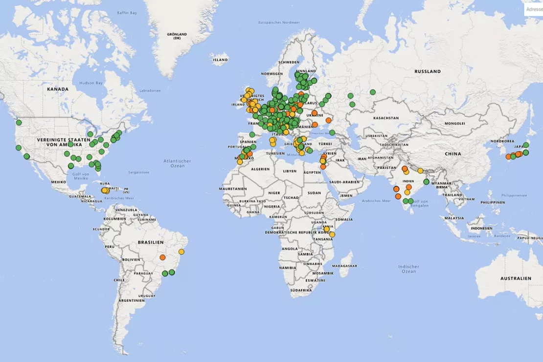
Precise geocoding of addresses and POIs for over 70 countries: the JoinAddress Geocoder API offers the highest geocoding quality worldwide!
In this interview, our experts answer the following questions:
- What does the Geocoder API do?
- Can companies implement geocoding easily and effectively with the JoinAddress Geocoder API?
- Why is JoinAddress offered in two different versions?
- What do companies use geocoding for?
- On-premises: Which customers use the JoinAddress Geocoder API as a local installation and why?
- Web service: Which companies use JoinAddress for cloud-based online geocoding and why?
- Are there any companies that use a combination of the on-premises and the web service Geocoder API?
- What does data sovereignty mean in the context of the JoinAddress Geocoder API, and why is it relevant for my businesses?
- What customization options are available for the Geocoder API with JoinAddress?
- What are the advantages of JoinAddress compared to the geocoder API from Google or Bing, and why?
- How complex is the integration of the JoinAddress API into existing business processes?
- What advice do you have for companies that are still unsure about which business model is right for them?
- These companies use JoinAddress. Have a look at the case studies!
- Your contact: Request a free initial consultation
What does the JoinAddress Geocoder API do?
Harald Meier: The Geocoder API from JoinAddress is a powerful interface for the automated validation and geocoding of address data and POIs. It takes basic data such as the ZIP Code, city, street, and house number and returns verified addresses enriched with geocoordinates. The API is technology-neutral, easy to maintain, and can be individually configured, for example, for specific country formats, based on stricter data protection requirements, or company-specific rules. The JoinAddress Geocoder API integrates seamlessly with existing IT systems such as CRM, ERP, or GIS and supports business processes such as customer management, risk assessments, and more.
Can companies implement geocoding easily and effectively with the JoinAddress Geocoder API?
Harald Meier: Yes! For over 30 years, JoinAddress has been a proven solution for companies that want to process address data automatically. With JoinAddress, over 70 countries can be geocoded with pinpoint accuracy. We are continually developing the technology further. Recently, we integrated AI methods to process unstructured data faster and better. We of course also focus on security and, above all, the quality of the geocoding.
Why is JoinAddress offered in two different versions?
Renate Dumberger: Companies have different requirements in terms of data security, degree of integration, and data volume. That is why we offer two JoinAddress solutions:
- On-premises for maximum control, local data storage, highest security, and large data volumes.
- Web service for rapid implementation, external maintenance, easy scaling, and GDPR compliant with secure hosting on EU servers only.
This allows companies to flexibly decide how they want to use the Geocoder API, depending on their technical infrastructure and data protection requirements.

5 Steps to JoinAddress on-premises Geocoding
- Requirements check: which countries are needed, which system components (databases, operating system, etc.) are suitable?
- Delivery of the installation package with licenses
- Installation and API integration into desired systems
- Geocoding in desired intervals and quantities
Image: Overview of the JoinAddress system components and the different integration solutions

How geocoding works with the JoinAddress web service
- Register or login
- Check your Excel list or txt file and if needed prepare it for geocoding (e.g. enter a country code)
- Create a project and upload your address list
- Perform the geocoding and check the results (directly on a digital map)
- Download your address list complete with coordinates as an Excel or txt file
Which geocoding solution is best for your needs? We will help you make the right choice!
What do companies use geocoding for?
Renate Dumberger: Advancements in data and software continue to increase the quality of address location. This opens up broader areas of application and the topic of address geocoding is generally attracting more interest. This can be explained quite well by taking a look at the retail and insurance industries. Retail chain stores need exact location data for expansion planning while insurance companies rely on accurate geocoding to help assess properties in terms of flood risk for example. Many of our customers also use JoinAddress for address validation, which means that they check the address records for correctness and completeness. This is especially important for postal mailings and marketing campaigns. We use official reference addresses to check the addresses and detect possible discrepancies. For example, an incomplete address can be corrected, which significantly improves delivery accuracy.
On-premises: Which customers use the JoinAddress Geocoder API as a local installation and why?
Harald Meier: The on-premises solution is operated directly within the company's own IT infrastructure. The addresses and results never leave the company network. For companies with highly sensitive data, the on-premises installation of the Geocoding API is the only option.
The on-premises solution is valued by companies for the following factors:
- Data sovereignty: All the processes run internally, making it ideal for sensitive data.
- High degree of customization: Integration into existing database and business processes
- No data volume limitations: Ideal for large data volumes or regular batch processing. You define when new data is geocoded, for example, always overnight or directly the data is captured.
Industries and companies that use the on-premises JoinAddress Geocoder API include, for example:
Insurance Companies and Banks
Renate Dumberger: A large reinsurance company uses the JoinAddress Geocoder API in-house for precise risk assessment in underwriting. The geographical location of properties, such as real estate or agricultural land, is analyzed to determine the probability of natural hazards such as earthquakes, floods, storm damage, or mudslides. Based on this location assessment, risk classes are created and corresponding insurance premiums are calculated.
Banks geocode the address data for several million customers as a basis for potential and market analyses.
These two examples show: The on-premises JoinAddress Geocoder API, installed in the company, is the ideal solution for processing large volumes of highly sensitive data.
HealthCare
Harald Meier: In healthcare, facilities use geocoding to improve care in rural areas. For example, statutory health insurance associations use JoinAddress to geocode the population and medical facilities in-house in order to subsequently develop more efficient medical care plans and improve accessibility for patients.
Internal Security
Renate Dumberger: The police also use geocoding, for example to locate accident black spots and crimes. These do not always occur at a precise postal address, but also happen, for example, on the motorway or in parking garages, and also have to be located exactly. That is why there is special data (such as POIs) and algorithms that enable the precise location of these points. Geocoding also plays an important role for rescue services and fire departments. The emergency services require very precise reference data, ideally based on GPS-accurate coordinates, in order to locate the sites of emergencies such as fires or accidents quickly and accurately, even if they are in remote locations. Using addresses is just the basic approach. There are a variety of positioning methods that are tailored to specific needs, such as those of police or emergency services.
Retail
Renate Dumberger: For retail chains, precise location analysis is crucial, for example, to optimize the distribution of branches and plan new locations. By geocoding their customer addresses, retail companies can find out where potential customers live and launch targeted marketing campaigns accordingly. This leads to significant increases in sales in newly developed areas.

“The on-premises solution is operated directly within the company’s own IT infrastructure. The addresses and results never leave the company network. For companies with highly sensitive data, the on-premises installation of the Geocoding API is the only option.”
Harald Meier, Senior Software Developer
Do you need to geocode large amounts of data with maximum data sovereignty and security? The JoinAddress Geocoder API can be implemented into your IT infrastructure.
Web service: Which companies use JoinAddress for cloud-based online geocoding and why?
Renate Dumberger: Companies from various industries use our geocoder web service. They particularly value the following features:
- Data protection compliant: All European data protection requirements are fulfilled.
- Secure hosting in the EU: The data is hosted on WIGeoGIS owned servers within the EU.
- Fast availability: No local installation is necessary; companies can geocode directly after registration and activation. Simply upload an excel file and get started.
- Affordable and predictable: You choose what geocoding quota you want to purchase. There are no expiry dates or subscriptions.
- Maintenance-free: Updates are performed automatically.
Industries and companies that use the JoinAddress geocoder as a web service include:
Authorities and Organizations
Renate Dumberger: Authorities and organizations geocode the locations of their facilities quickly and easily to use the results for maps, analyses, and efficient, needs-based planning.
Consulting Firms
Harald Meier: Consulting firms use the JoinAddress geocoder web service to convert their client address data into geographic coordinates quickly, accurately, and anywhere with no need for installation. Some use JoinAddress, for example, to spatially represent customer and location data in geomarketing projects and to conduct precise analyses such as distance or catchment area evaluations. Others use the web service to locate non-geocoded customer data, such as recipient, structure, and shipping locations, and create customized supply chain maps. This creates real added value in customer consulting and process optimization.

“Companies from various industries use our geocoder web service. They particularly appreciate the fact that with JoinAddress Web they can perform GDPR compliant geocoding on secure servers hosted in the EU, with low maintenance, low costs and high speeds.”
Renate Dumberger, Senior Manager
Want to geocode 400 addresses worldwide for free? Simply contact us, and we will happily activate your trial quota for JoinAddress Web!
Are there any companies that use a combination of the on-premises and the web service Geocoder API?
Renate Dumberger: Yes, such hybrid solutions are actually quite common. A typical example: A company uses JoinAddress on-premises on the one hand for geocoding large amounts of addresses in its primary market, such as Germany or Austria. This is efficient, especially when regularly geocoding high volumes of data.
On the other hand, for international addresses that are only geocoded occasionally as part of a global opinion poll for example, the company additionally uses the JoinAddress web service. This allows you to flexibly cover your geocoding needs without having to license additional country packages for rarely used regions.
What does data sovereignty mean in the context of the JoinAddress Geocoder API, and why is it relevant for my businesses?
Renate Dumberger: Data sovereignty means: All your data remains inside your company. Nothing is transferred to or stored in the cloud or any external systems. This is a crucial criterion for many of our customers, especially when it comes to personal, sensitive, or security-critical data. With the on-premises version of JoinAddress, companies retain complete control over their data flows, from address validation to geocoding.
Companies also retain control of their data when using the JoinAddress web service. Once you have finished geocoding your addresses and downloading the coordinates, you can completely and permanently delete all the data and projects that were uploaded to JoinAddress.
What customization options are available for the Geocoder API with JoinAddress?
Harald Meier: Unlike cloud solutions such as Google Maps or Bing, JoinAddress can be customized to meet your company-specific requirements. Examples:
- Custom search logic: e.g., preferred ZIP Codes, ignored name suffixes, or spelling variations.
- Special fallback scenarios: e.g., geocoding to the ZIP Code level if the house number is missing.
- Individual ID assignment & separate data storage: Addresses can be linked to internal reference identifiers in compliance with data protection regulations and enriched externally without disclosing personal data.
Can you share an example of a highly customized JoinAddress Geocoder API?
Renate Dumberger: The high flexibility of the JoinAddress geocoder API is demonstrated, for example, in the development of the DataCoder for our data partner panadress. panadress uses JoinAddress to enrich addresses with a PAN ID from its own reference database. The PAN ID can then be used to access microgeographical characteristics from the panadress data pool for customer and market segmentation without directly enriching customer addresses with characteristics, disclosing personal data, or mixing the data pools. This custom interface adaptation enables data protection-compliant processing, a functionality that is not offered by standard geocoder APIs.
What are the advantages of JoinAddress compared to the geocoder API from Google or Bing, and why?
Harald Meier: Large providers like Google or Bing offer geocoding only as an ancillary service. Their APIs are standardized and not designed to meet individual requirements. This is because their core business lies in online advertising, not in providing customized geodata solutions. Accordingly, there is often a lack of economic interest in making functions like JoinAddress flexible and customer-oriented. Compared to large cloud providers like Google or Bing, JoinAddress offers clear advantages, especially in terms of transparency, data protection, and flexibility.
The following points show why many companies consciously choose JoinAddress:
- No Black Box: With JoinAddress, it is transparent which data is processed and how, unlike Google/Bing, where logic and data sources are not disclosed.
- GDPR compliant: JoinAddress can be operated entirely on-premises, while with Google/Bing, the data always automatically ends up in the cloud.
- No storage and usage restrictions: Geocoordinates obtained via APIs from Google/Bing are often not allowed to be permanently stored or reused freely.
- Customization: Country-specific and company-specific customizations are possible, unlike with the standardized APIs from Google or Bing.
- Clear license models: JoinAddress is backed by a transparent licensing model and clear terms of use. Pricing models of large providers change frequently and are sometimes complex.
How complex is the integration of the JoinAddress API into existing business processes?
Harald Meier: Integration is generally straightforward. JoinAddress is technology-neutral and can be integrated directly into existing CRM, ERP, or GIS systems, for example. The on-premises solution with the standard requirements is often installed within a few hours. Companies can start geocoding immediately, without lengthy development efforts.
What advice do you have for companies that are still unsure about which business model is right for them?
Renate Dumberger: It is best to clarify your specific needs: How sensitive is your data? How big is your data volume? What IT infrastructure do you have? We provide our customers with individual consultations and also offer free trial access to our web service. If you require absolute data sovereignty and maximum depth of integration, we highly recommend choosing the on-premises solution. If you want to get started quickly and scale flexibly, the web service is ideal for you.
Would you like to know which Geocoder API solution is right for you? Simply contact us for more information!
These companies use JoinAddress. Have a look at the case studies!

Case Study Archdiocesan Ordinariate
Daycare centers, churches, parish homes - the Archdiocesan Ordinariate of Munich and Freising uses modern GIS tools from WIGeoGIS when planning the needs for the building infrastructure.

Expansion planning at dm-drogerie markt
Location decisions are among the most important and long-term tasks in the development of a commercial enterprise.

Fighting crime with GIS-based street network analysis
The latest example of the Bavarian Police: detention of the car carrier shooters

Raiffeisen Banking Group: Geocoding and Penetration Analyses
The Raiffeisen Banking Group uses JoinAddress to geocode addresses across the entire group and relies on demographic data from WIGeoGIS for penetration analysis and customer acquisition.

GIS Technology in Risk Management at Munich Re
For Munich Re, GIS applications are an indispensable part of risk management.

Geocoder Innovation: Marketing Tool from panadress with WIGeoGIS Technology
The DataCoder from panadress is a marketing tool for enriching microgeographic information that complies with data protection regulations.

Finding Exact Geocoordinates: Real Estate Valuation at vdpResearch
vdpResearch creates over 600,000 valuations annually. They are based on coordinates provided by the JoinAddress geocoder.

Geocoder Software JoinAddress
Find exact coordinates for your worldwide addresses from Excel files or databases. JoinAddress is smart, fast and stands out with its exceptional price-performance ratio.
JoinAddress Geocoder API: Request a free initial consultation
- FREE initial consultation on JoinAddress Geocoder API
- Non-binding, without further obligations
- By telephone or video call
Do you have questions about the JoinAddress Geocoder API? I will gladly support you. Please contact me!

