Geodata: Street Data, Digital ZIP Code Boundaries and Web Services
With geodata, companies make the right decisions to address the question of “Where?”
Geodata is...
- Street networks for routing or distance calculation
- Digital boundaries like ZIP Codes, administrative units
- Points of interest like schools, hospitals, companies
- Rivers, power lines, railway lines, property lines
- Digital maps and much more
Whether for location analysis, sales territory planning, route planning for your vehicle fleet or for marketing measures, with the right geodata you can choose the best strategies for your business.
Which Geodata Are You Looking For?
At WIGeoGIS we provide the best geodata for your specific needs.
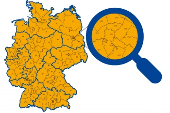
ZIP Code Map
ZIP Code maps are used to present topics in relation to location. We provide ZIP Code maps for your geo-analyses or as pure geometries for graphic artists. Also including market data upon request.
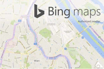
Bing Maps - Geodata as Web Services
Bing Maps are high quality worldwide web services from Microsoft that provide maps, aerial photos, geocoding and routing. WIGeoGIS is an authorized distributor.
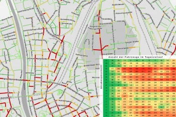
Traffic data for Mobility analysis & Traffic Planning
Use detailed traffic data from TomTom via WIGeoGIS for precise mobility analyses, traffic planning, and location analysis.
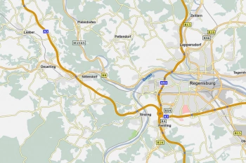
WIGeoStreet – Precise vector maps for Europe
WIGeoStreet are precise vector maps based on TomTom Multinet-R. For all of Europe and numerous other countries. Ready for use in all GIS systems.
Road Data for Logistics and Fleet Management
Global road data from TomTom with comprehensive routing and navigation attributes—ideal for use in logistics, telematics, transport management, and freight forwarding.
Are you interested in our Geodata? Request test data with no obligation.
What are Geodata?
Geodata is digital data that has a spatial reference. Digital maps are also geodata. Geodata is mostly used in geographic information systems (GIS). For companies, geodata forms the basis for all strategic business decisions that revolve around the question of “Where?”, such as:
- Where do I find my target group?
- Where is the best place to position my employees and sales representatives?
- Where should I open new branches and locations?
- Where should I take marketing measures?
Geodata offers you the digital basis for answering all your “where” questions.
What relevant Geodata exists?
Geodata is data with a spatial reference that can be located and displayed on a digital map. There are basically three types of geodata:
- Points: Point-to-point geodata refers to addresses and location data (e.g. addresses of branches or customers)
- Lines: Linear geodata refer, for example, to streets, routes, power lines, etc.
- Polygons: Area-shaped geodata, for example, is related to continents, countries, cities, municipalities, districts or even smaller areas such as building blocks
What role does Geodata play for companies?
Thanks to geodata, important company information can be displayed spatially, in other words on a digital map, regardless of whether it is the addresses of branches and locations, the routes of sales representatives or customers or the planning of marketing measures.
“The central question for geodata is “Where?” Looking at the results on a map makes it easier to see structures and connections between the data than in normal data tables.”
Martin Ortner, Manager at WIGeoGIS Vienna
The geodata is displayed in a geographic information system (GIS), using software such as WIGeoWeb, WIGeoLocation or QGIS. The goal is to use geodata and its spatial representation on a digital map to recognize patterns and connections that are not apparent without a spatial reference, thus creating added value.

In which use cases is geodata helpful?
Application Example 1: Acquiring New Customers
A Swiss pharmaceutical company has an Excel list with the addresses of doctors who are already customers and another with doctors who are potential customers. If you put the two lists on a map as geodata, you can visually superimpose them on top of each other and thus recognize important connections, for example: Near doctor X, there are two other doctors who are not yet customers. The sales representative for that area can also introduce themselves during their next visit to X and perhaps win over new customers.
Application Example 2: Analysis of Sales Losses
An Austrian insurance company loses ten percent of its customers in a year. However, the customer database does not answer the question of “where”. Yet, it is absolutely relevant where the company lost the customers. Was the loss spread across Austria or did it take place in a specific region? This valuable information only becomes apparent through geodata, namely when the customers’ addresses are visually displayed on a map.
Application Example 3: Determine Location Potential/Define a Catchment Area
A German fast food chain is considering several potential locations for a new branch and has to choose one. The chain wants to know how many potential customers live or work in the catchment area within a 15-minute drive. Thanks to geodata and GIS software, this question can be answered in just a few clicks. In the background is the combination of geodata such as traffic routes, average travel speed, number of inhabitants, their age and purchasing power. Information about nearby competitors can also be included. Finally, the map shows how many customers can be reached within a 15-minute catchment area and it becomes clear which location has the most potential.
Geodata: High Quality and Up-to-Date. Try and see for yourself.
What makes data Geodata?
For example, companies that want to display their Excel address lists in GIS software so that they can create spatial patterns and references must first geocode their addresses. This is because a geographic information system (GIS) cannot do anything with an address list alone that does not contain any geo-coordinates.
Geocoding provides addresses with precise coordinates so they can be located on a digital map. For companies with data that still needs to be geocoded, they can do so easily themselves using JoinAddress, the geocoding tool from WIGeoGIS. Of course, WIGeoGIS can also perform the geocoding for you.
The next step is the combination of geodata, because the crucial added value for businesses lies in linking the geodata with business-relevant information and displaying it on a digital map.
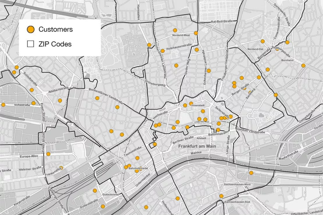
“Various attributes and information can be attached to a geodata set, be it point, line or area data, for example internal information such as the number of customers per ZIP Code or external information such as socio-demographic data or traffic data such as the number of vehicles that drive on a certain road each day.”
Norbert Hackner-Jaklin, Senior Manager at WIGeoGIS Vienna
Where does geodata come from?
There are internal and external geodata. Internal company geodata is generated by the companies themselves. This data includes, for example, addresses of sales and service representatives, customer information, such as how many customers shop in a particular branch or their billing address, logistics data such as inventory levels or the number of products sold by location. Branch addresses or addresses of potential locations, real estate, infrastructure and much more are also company geodata.
Geodata comes primarily from a variety of external data providers. Three groups can be distinguished here:
- Public institutions, such as the Federal Office for Metrology and Surveying, Eurostat, state statistics offices etc.
- Commercial data providers, who collect information such as road data, traffic data, traffic jams or market information such as purchasing power and sell it as data products. These include, among others, TomTom and Bing Maps, for whom WIGeoGIS is a licensed partner.
- Open
data or open source data, such as OpenStreetMap (OSM). This is geodata
from various sources that is collected by institutions, companies or
individuals and presented in a structured manner on digital maps.
Test Geodata for free with no obligation!
Creating future forecasts with Geodata
Geodata can also be used to create predictions and future scenarios, for example for questions such as:
- What would happen if I close a branch?
- How many customers will I lose to the competition?
- How does a shift in traffic affect my potential?
“In geomarketing, we not only analyze the current situation, but we also try to use geodata to predict spatially based behavioral patterns.
We pour reality into a model, change the model parameters and see what this change would actually bring about.”
Norbert Hackner-Jaklin, Senior Manager at WIGeoGIS Vienna

Personal consultation on Geodata
Geodata is the core business of WIGeoGIS, because geodata is to geomarketing experts what flour is to a baker: the starting point for all products and services.
- Do you have a specific question that geodata can help with?
- Are you looking for specific geodata that you want to process yourself?
- Would you like to display and analyze internal and external geodata in a WIGeoGIS software product?
We are your geodata specialists and will consult and support you in finding the geodata that is best suited for your needs. In this way, you get exactly the geodata that will significantly advance your company, no matter how large or small or industry-specific your geodata needs may be.
Geodata: Test now free of charge and without obligation!
- Test data*: ZIP Codes, road data, traffic data and more
- Non-binding, free test
- Test ends automatically without cancellation
I will gladly support you, also by telephone.
* Information about the free test data: Selected test data is available for standard regions in Germany or Austria. For Germany, the data is for districts in Munich and the surrounding areas. For Austria, the data is for districts in Vienna and the surrounding areas. The products of WIGeoGIS are intended for companies and are not suitable for private use. If you need a one-time market analysis, we will gladly make you a service offer.
FAQ
-
How does geodata support data analysis?
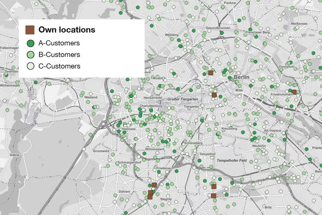
Geodata helps you put information into a spatial context, thereby allowing you to recognize patterns and better understand spatial relationships. By displaying data as geodata, companies can, for example, visually locate their A, B and C customers on a digital map to help them make strategic decisions. For example, a typical data analysis question that geodata helps with is: In which regions should we increase our sales and marketing activities?
Find out more about the use of geodata for data analysis in our expert interview on the topic of geodata with Norbert Hackner-Jaklin and Martin Ortner.
-
Can geodata have different geographical projections?
WIGeoGIS uses the projection from Web Mercator, one of the most common projections used, for example, by map services such as Google, Bing or, in Austria, Basemap. If a customer has data in a different projection, we can help them import that projection into the Web Mercator projection. Or the geodata can be imported directly into the desired projection.
-
In which file formats is geodata stored and used?
The most common file formats in geomarketing are Shapefile, GeoJSON, GeoPackage and File Geodatabase. However, data from Excel or Access files or other table formats can of course also be imported into a GIS, as long as they are provided with an X and Y coordinate, i.e. geocoded.
If companies have addresses without X and Y coordinates, these can easily be geocoded using the geocoder software JoinAddress. Of course, WIGeoGIS is also happy to perform the geocoding for our customers. We are always happy to answer any questions. Simply contact us!
-
Who uses geodata?
Over 80 percent of all data has a spatial reference. This means that geodata is omnipresent in both business and private life, often without users being aware of it.
In private life: Most of us use geodata several times a day, for example to look up an address on Google Maps, to find the nearest bank branch or to see when the next tram is coming. Even when we check the weather forecast, we use geodata because we want to know what the weather will be like in a particular city or region.
In business: Geodata is omnipresent here too. For example, many CRM systems already have the option of displaying a map.
Special area geomarketing: WIGeoGIS offers decision-makers in organizations geodata to support business processes, both in the B2C and B2B sectors. Here, among others, controlling, marketing, sales, business development and management use geographic information systems (GIS).
-
Is the road data also available worldwide?
Basically, there are hardly any white spots left on the map: Road data is now available globally, albeit with varying data depth and attribute accuracy. Sometimes political or legal restrictions prevent road data from being provided, used and, above all, exported from the country. For example, there is now road data from India, but not from China.
-
For which countries are there digital ZIP Code boundaries?
ZIP Code boundaries are generally available globally, but WIGeoGIS focusses on Europe.
-
What functions do geodata-based web services offer?
The typical functions of geodata-based web services include:
- Displaying background maps for better orientation and spatial classification of information
- Address search with geocoding in the background
- Route calculation
- Calculation of catchment areas
- Complex analysis processes such as the calculation of distance matrices
- Real-time navigation
- As well as a number of geographically based analysis functions such as route optimization (In which order should a given set of addresses be visited for the fastest possible route?)
-
How or with which software can I use geodata?
If you want to use geodata, you need a geographic information system (GIS). On the one hand, there are expert systems that require prior knowledge (QGIS), and on the other hand, there are software (e.g. WIGeoLocation, WIGeoWeb) that answer spatial questions without GIS know-how.
This includes, for example, the web-based software WIGeoLocation, which creates a report in just three steps:
- Enter the address location
- Define the catchment area
- Select the report
-
Why do I have to geocode an address to use it in a GIS?
This is because a geographic information system (GIS) cannot do anything with an address list alone that does not contain any geo-coordinates. The intermediate step of geocoding is required, in which an address or location is given an X and a Y coordinate. This can be done quickly and easily with the geocoder software JoinAddress.
Some geomarketing software does geocoding automatically in the background. This intermediate step is subject to a fee because it involves licenses.
Our WIGeoGIS experts are happy to consult you on integrated geocoding and geocoding with JoinAddress.
-
What distinguishes geodata from basic geodata?
Geodata is refined, in geomarketing we speak of enriched basic geodata.
- Geobased-data represents the original spatial reference, for example, addresses, streets, ZIP Codes, etc.
- Geodata provides additional information and is linked to other information; for example, a ZIP Code can be enriched with the number of residents or the number of customers. This is how basic geodata (in this example a ZIP Code) becomes geodata (including information about a ZIP Code).
-
Which strategic business questions can be answered by geodata?
Among other things, you can use geodata and geomarketing to:
- Analyze and compare locations
- Optimize branch networks
- Create sales forecasts
- Identify target groups
- Calculate market potential
- Plan sales territories
- Optimize regional marketing
-
Why is geodata valuable?
The importance of geodata is demonstrated by the fact that more than 80 percent of all information has a spatial reference. The value of geodata can be seen in everyday life, from business decisions to science, such as environmental research. Geodata helps to better understand spatial relationships, to better classify spatial information and to make forecasts for the future.
-
How do I know if geospatial data is relevant for my business?
Geodata is relevant for your company if your question has spatial relevance. The probability that this is the case is very high, because more than 80 percent of all information and data already have a spatial reference, and this percentage is constantly increasing.
-
Do geographic information systems also work with real-time data such as traffic jam information?
Real-time data on traffic jams, weather, etc. is available in increasing variety and can also be integrated into geographic information systems (GIS). We at WIGeoGIS also sell real-time data, e.g. live traffic data from TomTom.
Whether or which real-time information is integrated into a GIS depends on the application. For example, when it comes to strategic decisions, real-time data is not relevant.
-
What if companies want to analyze geospatial data but do not want to purchase software?
Companies that analyze geodata but do not want to buy their own software can rely on web-based solutions as Software as a Service at WIGeoGIS. The only thing they need for this solution is a web browser and an internet connection. We are also available as consultants and can also perform one-off analyses for organizations and companies.
-
Is there geodata that customers request but that no one has yet recorded?
Yes! This can have two main reasons:
- Either it is very special data that is not collected because, for example, it is not economically relevant for any data provider.
- Some geodata are not available because legal or political regulations make collection impossible, for example for reasons of data protection and national security.
-
How much geospatial data can be overlaid in the GIS software?
Theoretically, an infinite amount of geodata can be superimposed on one another in a digital map, as there are hardly any technical limits to the representation of data.
But in practice there is a limit: that of human perception and comprehension. When it comes to classification on a digital map, for example, an average experienced map reader can usually only distinguish no more than seven colors.
An overload of data also makes little sense because in geomarketing we want to help people make more informed and better decisions, and that is not possible if the visualization becomes too complex.
-
What advantages does the reporting function offer for geodata analysis?
The reporting function in the WIGeoGIS services offer the following advantages:
- The reports are standardized
- This means that the reports are comparable with each other
- They are easy to use
- The reports can be automated, for example they can be set to automatically deliver a spatially based analysis to your inbox every Monday
Digital geodata for your GIS solutions – up-to-date, global, and flexible. Whether for geomarketing or location analysis, we provide the right map.

