Geocoding
What is it? And what is it used for?
With geocoding, you can convert locations and addresses to X/Y coordinates and vice versa. All you need is a geocoder software. Here you will find tips and everything you need to know about geocoding and geocoding tools.
Everyone uses it in everyday life, few know what it's called: We are talking about geocoding. Because every time you type an address into a map and you are then shown a point on the map, a so-called address geocoding takes place in the background. We answer all your questions concerning the topic of geocoding, geocoder, tools and give useful tips for practical use.
What is geocoding?
With geocoding, software converts address data into geodata. This is done by assigning the appropriate X/Y coordinate to an address. Geocoding enables you to convert addresses into coordinates.
The coordinates are required to visualize locations on a digital map (e.g. Bing Maps, Google Maps) or in geographic information systems (GIS software). Only with the geocoding process are you able to display your addresses on a map as points (pins) or as geometric shapes for an entire area.
The addresses to be geocoded do not have to be complete. It is ok if parts of the address are missing (e.g. house number, postcode, etc.). Because with geocoding, you can also assign geographical information in the form of map coordinates to locations, states, postcodes, etc.
Of course, the following applies: The more complete the address, the more precise its location on the map.
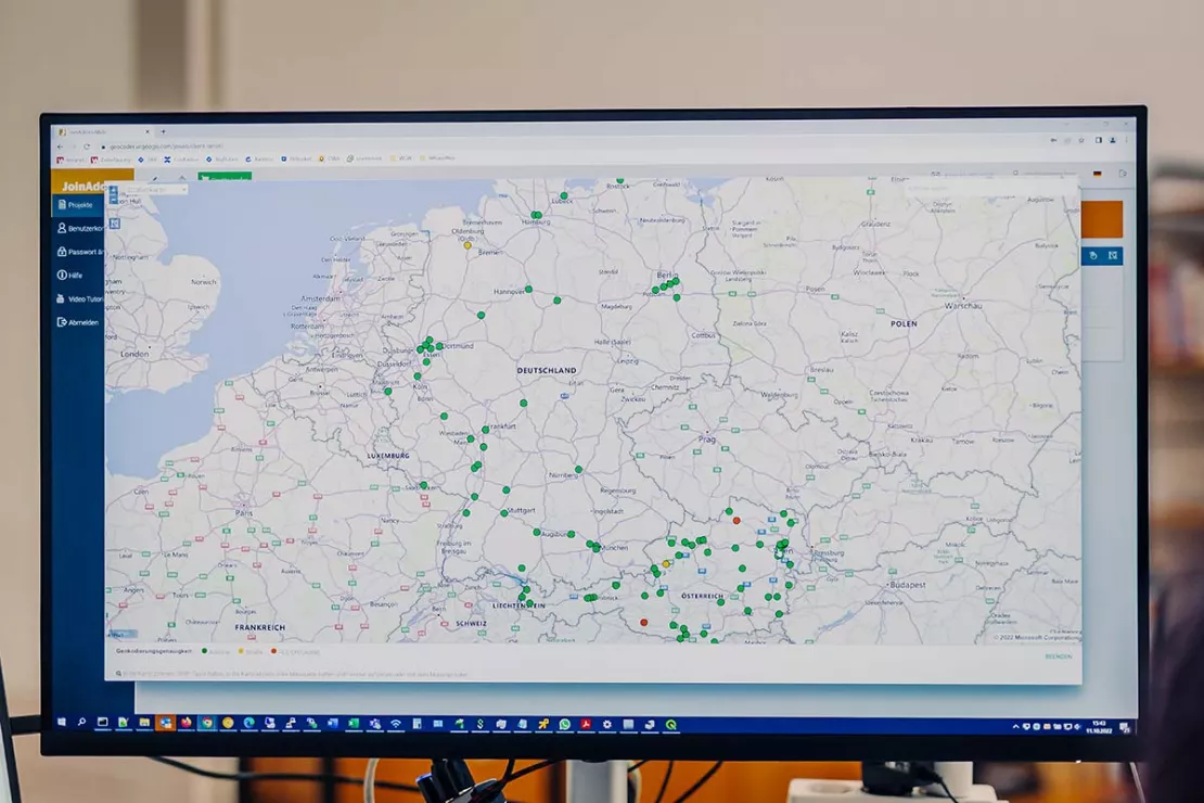
“Show me an address and I'll tell you where you are on the map” - With geocoding, you can locate addresses and locations on the digital surface of the earth. Expressed more simply: You can quickly convert addresses into coordinates. Want to try it out? Go for it! Geocode 400 addresses for free with JoinAddress.
Types of Geocoding
1. Address Geocoding: From Address to Coordinate
Basically, every geocoding is an address geocoding, and for certain locations (for example, a lake or a mountain), the address is not quite as precise as for a customer address or a branch location. For companies and organizations, the most common application of geocoding is the geocoding of addresses. Because this allows addresses to be converted into coordinates.
Companies then use the generated coordinates for geomarketing, market, potential and location analyses, as well as for the visualization of customers, locations and supply chains and similar applications. The addresses to be geocoded are often addresses of customers, suppliers, branch locations, competitor locations, points of interest etc. By the way, you can find more on how companies use coordinates further down in the text.
2. Reverse Geocoding: From the Coordinate to the Address
Geocoding has two directions. Some geocoders not only convert addresses into coordinates, but also the other way around. The software then converts the appropriate address with street name, house number, ZIP Code, place and country name. The direction from the coordinate to the address is called reverse geocoding.
Reverse geocoding is thus geocoding in reverse. You convert geo-coordinates into textual location information, i.e. into an entire address or city or country name etc. To do this, you need geocoding software that is explicitly suitable for reverse geocoding.
3. Batch Geocoding: Geocode Multiple Addresses at Once
Batch geocoding describes the geocoding of a large number addresses and is used very frequently by companies. Because most companies have very large amounts of addresses that need to be geocoded. Typing every address individually just does not make sense. Batch geocoding enables you to start the process once and the software then automatically geocodes many addresses at once. This saves a lot of time and nerves.
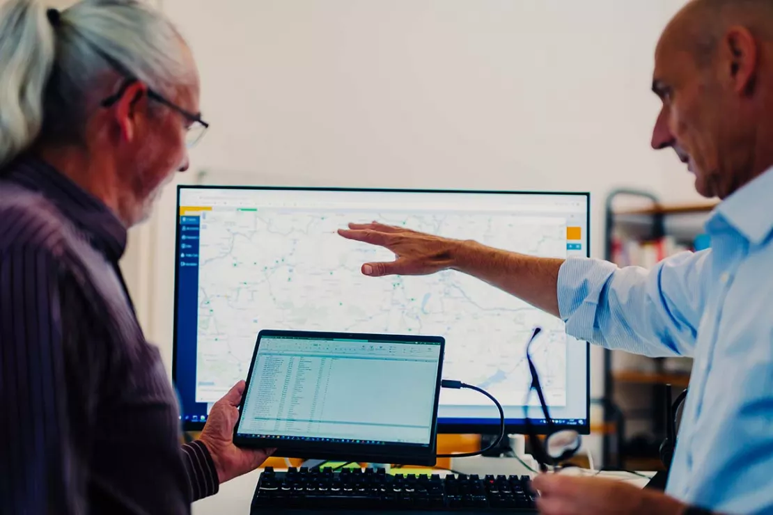
While the software works on its own, you can go get a coffee or work on other projects, depending on how many addresses you have to geocode. Geocoding approximately 50,000 - 100,000 addresses should give you enough time for a short coffee break. You can also start large projects with a clear conscience before heading home for the evening. The geocoder automatically calculates the project overnight. Even if your computer goes into standby mode, the geocoding process continues in the background.
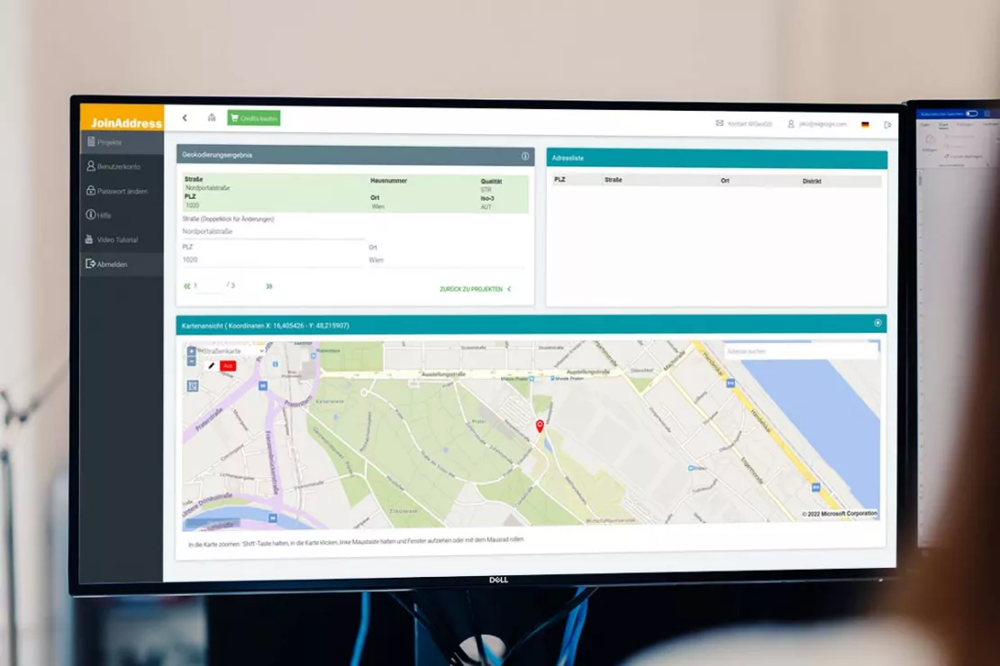
If required, you can easily edit geocoded addresses manually from the list or directly on the map. This means that you can quickly find and correct incomplete or incorrect addresses using geocoding.
Geocoding Software
For any type of geocoding, whether address, reverse or batch, you need suitable geocoding software, such as Geocoder JoinAddress from WIGeoGIS. JoinAddress can be tested free of charge!
Assigning a coordinate to an address and vice versa may sound simple, but it is far from it, because different components have to work together in geocoding. A geocoder works as follows:
Components of a Geocoder
A geocoding tool for professional use basically consists of the following components:
- A reference database in which addresses and geographic coordinates are saved.
- A server software that uses and searches the reference databases as sources to find, construct and output the appropriate coordinate.
- A batch function for geocoding mass data.
- Typeahead address search for the flexible entry of and search for addresses.
- A client software with which the geocoder is queried. This can be a locally installed client or a web client (for online geocoding).
The building blocks alone make it clear that a geocoder can only be as good as the reference databases it accesses. On the other hand, the geocoding software must be potent, meaning it works quickly and has an intelligent search algorithm. A batch function is essential for professional use. In addition, geocoders differ in terms of the flexibility with which clients can query the geocoding server.
This is how the geocoding process works
The different building blocks work together in the geocoding process. The following happens:
- You enter an address into the geocoder, for example Hansalgasse 3 in Vienna. The more completely you enter the address, the more precisely the software can locate it on the map.
- The intelligent geocoder software searches a gigantic reference database for your address and delivers the correct and most precise coordinates.
- This allows addresses to then be located and displayed on a map.
What types of geocoders are there? Which is the right one?
In the past, Geocoders were exclusively installed locally in the company, but today web services are also available that allow you to geocode directly in a browser. This corresponds to the current IT usage trends in companies. Modern geocoders therefore offer local and online geocoding. Both variants have their justification and advantages depending on the respective usage scenario and the needs of the company. That is why many companies do not choose one variant, but use both. Many companies geocode large amounts of data and sensitive data locally in-house, while for other addresses they use an external online geocoder. If you want to find the right geocoder for your specific needs, you have to take a close look.
Tip: How to recognize a good geocoder
What makes a good geocoder? Which one is right for me? It depends on your needs. Basically, geocoding software should have the following features:
- Completeness and accuracy of the reference data
- High quality of geocoding
- Transparency when displaying the geocoding result
- Speed and performance
- Possibility to edit addresses manually
- Simple and intuitive to use
- Secure storage and processing of your data. Only you and no one else uses your address information.
This is How Geocoding Works with JoinAddress
With JoinAdress, WIGeoGIS offers a modern geocoder that geocodes batches of addresses worldwide correctly, precisely and quickly. You can install the software locally in your company and use it for online geocoding via a web client.
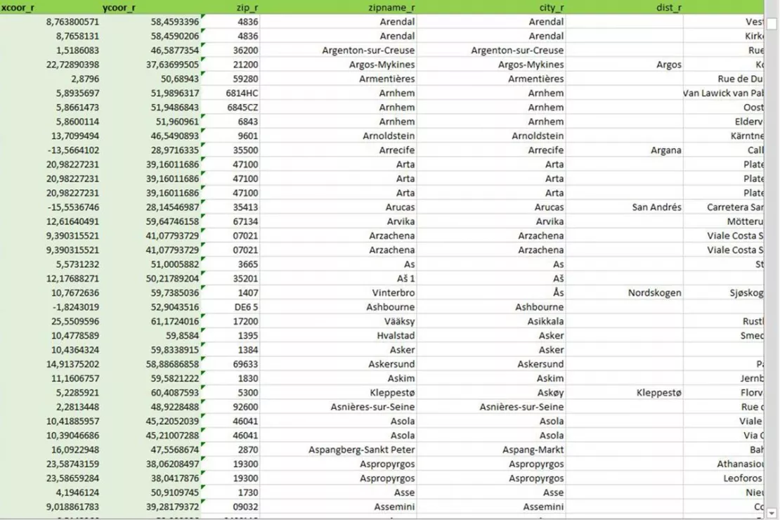
In the online version, simply upload your addresses from an Excel file. Your address data will be saved and processed on the WIGeoGIS server, which is located in our company headquarters in Vienna. Your data is secure. Nobody is reading along. Only you use your address data. After geocoding, you can permanently delete the project and all data. Your data and the geocoding result cannot be reconstructed. In addition, the JoinAddress Geocoder allows you to manually edit your addresses in lists and directly on the map.
In the video, you can see how to geocode with JoinAddress and learn about its features.
Register for free. Test our geocoder with 400 addresses for free!
Areas of application: Why use geocoding and what for?
Geocoding can be used in many business areas and now takes place in the background in numerous applications without us being aware of it. For example, every time we enter an address into a map application (e.g. Bing Maps, Google Maps), the address is geocoded in the background so it can be displayed as a point on the map.
Thus, geocoding is the basis for numerous company applications - whether as an address search tool in CRM and other databases, as a tool for address data analysis, as an address management tool or as a supplier of coordinates for location analyses, market analyses and geomarketing with GIS.
Companies geocode addresses from different business areas, such as addresses
- from customer databases and projects for the acquisition of new customers
- from locations of the branch network
- from warehouses, hotspots and other relevant locations within the supply chain
- from locations of the competition
- from points of interest
In combination with other company key figures and market data, geocoded address data provides the basis for numerous geo-analyses on sales, expansion, service and marketing issues. For these advanced geo-analyses, you need GIS software.
Coordinate Supplier for GIS Systems
Most companies geocode addresses in order to work with them in GIS applications. You can use coordinates in ArcGIS, QGIS, WIGeoWeb and other WebGIS solutions for geo-analyses of all kinds.
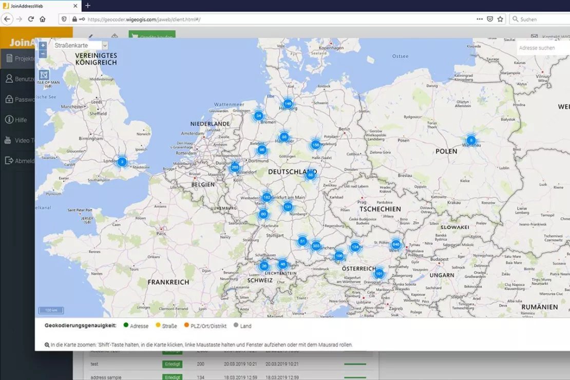
Analyze Addresses Visually
Companies use geocoding as a means of visual address data analysis. By locating addresses on the map, agglomerations (clusters) and other spatial patterns can be recognized immediately. This gives companies a new, important perspective for their business decisions. This perspective can be decisive for your business success.
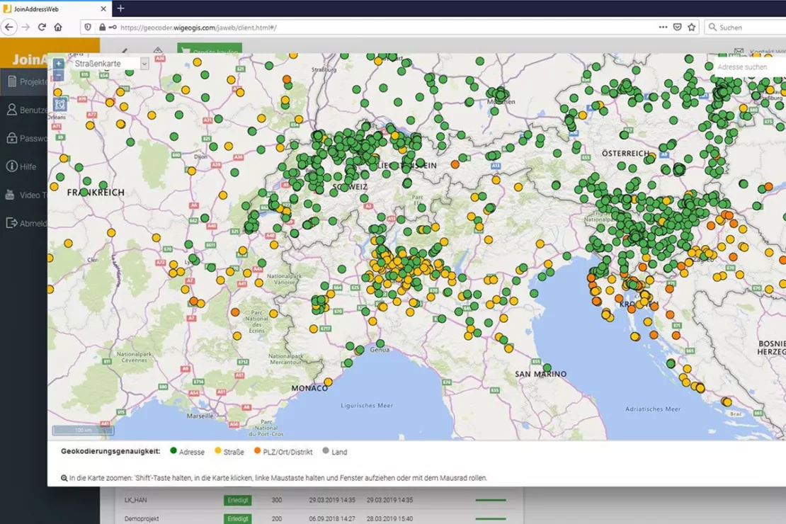
Manage Addresses
Every company has a large collection of addresses. Often these are not recorded in a uniform manner, but are incomplete or entered different systems. With geocoding, companies bring order into the address chaos.
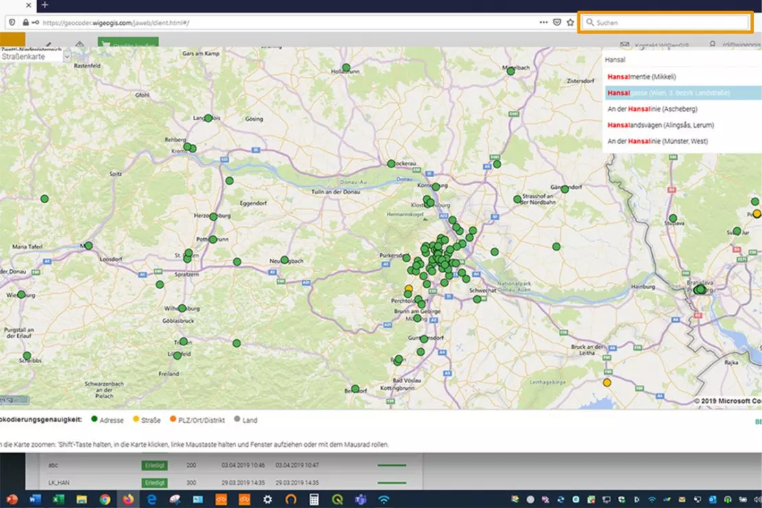
Address Search in Databases
Finding an address in a CRM or another application is often a problem. Companies solve this by integrating an address search tool that is based on geocoding. The address is found no matter how it is entered, no matter if it is incomplete or the street name or city name comes first. The tool always shows a suitable suggestion.
Expert Voices: This is What Companies Say
"We need coordinates in order to integrate customer data such as recipient, structure and dispatch locations into maps. This enables us to visualize customer-specific runtimes or the supply chain of the UPS network. As a rule, our customers cannot provide us with their data geocoded.”
Frank Schirmer, Customer Solutions - Supply Chain Optimization at UPS Europe
“At M&L AG we have worked with geomarketing issues and thus also with geographic data for more than 25 years. Geographic coordinates for address data are essential for answering spatial questions such as location planning and relocations, determination of catchment areas, travel time zones and distance measurements and competition analyses. Questions such as “Where is my shop located?” and “Where do my customers come from?” can only be answered if customer and location data for their address is correctly displayed on a spatial map and used for further calculations. For this purpose, the addresses are expressed by geocoding in geographic coordinates (x = longitude and y = latitude) and can thus be transferred to the geographic system easily, directly and without any loss of quality. The better the quality of the geographic coordinates, the more precisely the addresses are shown on a geographical map and the more precise the results calculated from them, for example when calculating the distance. That is why we work with the online geocoding tool JoinAddress from WIGeoGIS.”
Marcus Kessler, Senior Consultant and Authorized Signatory at M&L AG
“Spatial analytics and business intelligence in research and teaching do not work without address geocoding when working with real-world data and case studies. We need high quality geocoded addresses.”
Ass.Prof. Dr. Petra Staufer-Steinnocher, Deputy Head of Institute for Economic Geography and GIScience, WU Vienna University of Economics and BusinessCase Studies and More Information
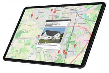
Finding Exact Geocoordinates: Real Estate Valuation at vdpResearch
vdpResearch creates over 600,000 valuations annually. They are based on coordinates provided by the JoinAddress geocoder.

GIS Technology in Risk Management at Munich Re
For Munich Re, GIS applications are an indispensable part of risk management.
Geocoder Software JoinAddress
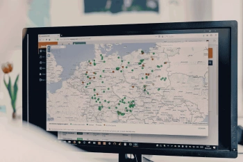
Find exact coordinates for your worldwide addresses from Excel files or databases. JoinAddress is smart, fast and stands out with its exceptional price-performance ratio.
Autocompletion and Geocoding
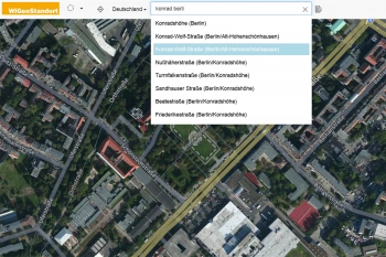
QuickSearch is an API for address autocompletion and geocoding. The API offers autocomplete and typeahead functions and can be integrated quickly and easily into any software.
WIGeoGIS is a Geocoding Specialist
WIGeoGIS has been developing geocoding software for SMBs, IT service providers and global corporations for more than 30 years. This also includes large companies such as Munich Re, for whom highly precise address localization is of the utmost importance.
WIGeoGIS is continuously further developing its geocoding software JoinAddress. Since 2017, the Geocoder is now also available online and combines a user-friendly interface with very up-do-date and highly accurate coordinates at a very fair price. More on Geocoder JoinAdress.
Geocoding: Fill out the form, test it free of charge & without obligation!
- Non-binding, free test*
- Test ends automatically without cancellation
- Geocode 400 addresses for free
FAQ
-
What does geocoding mean?
Geocoding means assigning an address a spatial reference through XY coordinates. It is also possible to link a GPS coordinate with the corresponding address. This is called reverse geocoding. Geocoding is what makes spatial analysis with addresses possible.
-
How can I use the JoinAddress WebClient?
Simply register on the start page of the application, purchase a quota, upload your data and start geocoding. The first 400 addresses are free.
-
What happens with my data after I upload it?
Your addresses are temporarily stored on the WIGeoGIS geocoding server. The data is then processed on the server. After the geocoding process is finished, you download your geocoding results (your starting addresses supplemented with geographic coordinates). You can then delete your address list from our server.
-
What formats can JoinAddress WebClient process?
You can upload your addresses as an Excel list or as a text file. You can also download your geocoding results in one of the two data formats.
-
Why do my addresses require a country code (ISO-3 code)? What is ISO-3?
The ISO-3 code is an international standard defined by the International Organization for Standardization (http://www.iso.org/). This organization defined country codes for each country providing them a unique, internationally recognized abbreviation. We work with this international standard for our geocoding. If you provide an address with an ISO-3 code, the geocoder can immediately assign it to the respective country. You can download a list of the ISO-3 codes here.
-
What degree of accuracy is possible in the different countries?
Generally, the geocoding accuracy depends on the coverage of the respective country. In places where the data depth is still low, detailed geocoding is not possible. WIGeoGIS works together with all the popular commercial data and service providers (TomTom, HERE, Bing) and provides the greatest possible accuracy for each country. The data is constantly updated, thus improving the accuracy.
Register now and test our geocoder for free.

