Recognize Spatial Patterns With Geodata
Geodata is data with a spatial reference that can be displayed on a digital map. This modeling makes it possible to recognize and analyze spatial patterns and connections between the data, enabling you to make sound business decisions.
An Interview with WIGeoGIS Experts on the Topic of Geodata
- What are Geodata?
- How can companies benefit from Geodata?
- How can Geodata best be evaluated and analyzed?
WIGeoGIS experts Norbert Hackner-Jaklin and Martin Ortner answer these and more helpful questions about geodata in the following interview.
All About Geodata
- What are geodata?
- What role does geodata play in geomarketing?
- What insights can companies specifically gain from geodata?
- Why do you need geodata for this?
- What types of geodata are there?
- How and why do you enrich geodata with other information?
- Where does geodata come from?
- How do companies get external geodata?
- How can customers work with their internal data in geomarketing software?
- Is it more expensive the more geodata you need?
- What do WIGeoGIS customers, who are usually not geomarketing experts, have to do themselves and what can WIGeoGIS do for them?
- More Information About Geodata
- Test Geodata Now for Free With No Obligation!
What are geodata?
Norbert Hackner-Jaklin: Geodata differs from other data thanks to one important enrichment: it includes spatial information. This means you can ask the question: Where is that? An example: The chemical formula of water is information, but I can not ask the question “where”. However, if the water is a lake, I am back to “where” and thus to geodata.
What role does geodata play in geomarketing?
Martin Ortner: In geomarketing, we help companies to display their data spatially, i.e. on a digital map, so that they can generate added value. “Where?” is the central question, for example: Where do we sell to? Where are our sales representatives? Where can we optimize something? It is often easier to see structures and connections in the data by looking at maps rather than lists and tables.
Test the Geodata now for free with no obligation!
What insights can companies specifically gain from geodata?
Norbert Hackner-Jaklin: A company may lose ten percent of its customers in a year. To find out why this could be, one of the relevant questions to ask is “Where did we lose the customers?” It makes a difference for example, if the loss of customers is spread equally across Austria or if it occurs exclusively in a specific region. With this knowledge, which is only made possible by geodata, the company can make solid business decisions.
“A company may lose ten percent of its customers in a year. To find out why this could be, one of the relevant questions to ask is “Where did we lose the customers?” It makes a difference for example, if the loss of customers is spread equally across Austria or if it occurs exclusively in a specific region.”
Norbert Hackner-Jaklin, Senior Manager at WIGeoGIS Vienna

Why do you need geodata for this?
Norbert Hackner-Jaklin: Geodata makes it possible to recognize spatial patterns, structures and connections. Sticking with our example: Let us say a company has a database with all the addresses of customers who cancelled in the last year. Based on the addresses or ZIP Codes, it is difficult or impossible to determine if there is a regional concentration of cancellations. For example, the ZIP Codes 1230 Vienna and 2380 Perchtoldsdorf are right next to each other. This connection would never be recognized in a table without concrete local knowledge.
Would you like to explore this topic more playfully? Then watch our video about it!
What types of geodata are there?
Martin Ortner: Geodata is all data that has a spatial reference and can be displayed on a map. It can be point information such as an address or location. Streets, highways or rivers are examples of linear geodata. And then there are area geodata such as continents, countries, districts, cities, municipalities, ZIP Codes and even smaller units. The added value for companies comes from enriching geodata with additional information.
How and why do you enrich geodata with other information?
Norbert Hackner-Jaklin: Depending on the strategic issues and planning in the company, a spatial reference can be enriched with attributes such as socio-demographic information, like the number of residents, the average income or the average age in the area. These are all examples of external data. Internal company data can also be linked to the spatial reference, for example the number of customers per district. Furthermore, traffic data can be linked to geoinformation, such as how many vehicles drive on a street.
Are you interested in our Geodata? Request test data with no obligation.
Where does geodata come from?
Norbert Hackner-Jaklin: Geodata comes from a wide variety of sources. There are internal and external geodata. Internal geodata is the data that companies collect themselves, such as data on pipe networks or customer data. External geodata comes from official bodies such as surveying offices or statistics institutes. Commercial data providers such as TomTom or Bing Maps also provide geodata, in this case road and traffic data. A third area is crowdsourcing data, in other words projects like OpenStreetMaps (OSM).
How do companies get external geodata?
Norbert Hackner-Jaklin: At WIGeoGIS, we also offer consultation services. We work closely with our customers to help them find the best geodata for their specific needs. This allows them to perform quality analyses that provide exactly the information they need to make solid business decisions. More and more geodata sets are available on the market and the attribute depth of the geodata is also increasing, which means the choice for our customers is constantly growing. On the one hand, this is good, but on the other hand, it is important to concentrate on the data sets that are essential to your specific questions.
Martin Ortner: Customers can purchase original data or raw data, such as the traffic data from TomTom, and integrate it into their own software. However, most WIGeoGIS customers use geodata in our geomarketing software. There, the geodata is displayed directly on a digital map and you can generate automatic reports for your specific questions. We help companies determine which data is relevant to their questions and which geomarketing software, for example WIGeoLocation or WIGeoWeb, is most suitable for their needs.
“In geomarketing, we help companies to display their data spatially, i.e. on a digital map, so that they can generate added value. “Where?” is the central question, for example: Where do we sell to? Where are our employees and sales representatives? Where can we optimize something?”
Martin Ortner, Manager at WIGeoGIS Vienna

How can customers work with their internal data in geomarketing software?
Norbert Hackner-Jaklin: It is important that the source data, such as addresses, are provided with geocoordinates, as only then can a geographic information system (GIS) do something with it. So, if customers have pure address lists that they want to integrate into geomarketing software, they must first be given an X and a Y coordinate. Either we can perform this step or the customers can easily do it themselves using our geocoder software JoinAddress.
Try it out now! Request your test geodata today for free with no obligation.
Is it more expensive the more geodata you need?
Martin Ortner: This can be the case, but not necessarily, because the price depends on the license model and the type of data. There is data that is subject to a license as well as Open Data, which is available for free.
Norbert Hackner-Jaklin: Geodata tends to become more expensive the smaller scale it is, in other words the more granular it is. That is why it is important to find a balance between being as small-scale as possible but also as affordable as possible. In any case, accuracy just for the sake of accuracy is not useful.
What do WIGeoGIS customers, who are usually not geomarketing experts, have to do themselves and what can WIGeoGIS do for them?
Martin Ortner: Our customers do not have to understand anything about geodata. Our job is to work with you to determine which geodata and software are best suited to your specific needs or to achieve your goals. However, we also often consult customers who are already very knowledgeable and have their own GIS specialists, but are having difficulties with a specific issue.
Norbert Hackner-Jaklin: Ultimately, what is crucial for the success of the project is that the customer knows exactly what question they wish to answer. We cannot help with this because we are not specialists for the respective company and because the objective is often a strategic decision that we cannot make for them. For example, it must be clear whether the company wants to expand or restructure its branch network. We can then use spatial analytics and geodata to provide support and transparent information that helps to make sound, data-based decisions. It is basically like a visit to the doctor: I have to know what hurts, but the doctor makes the diagnosis and provides the treatment. However, in order for the doctor to give me the best help possible, I have to tell them exactly where it hurts.
Thank you very much for the interview.
Norbert Hackner-Jaklin: My pleasure.
Martin Ortner: We are happy to help interested customers with further questions about geodata and our WIGeoGIS services.
Geodata - further information

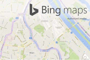
Bing Maps - Geodata as Web Services
Bing Maps are high quality worldwide web services from Microsoft that provide maps, aerial photos, geocoding and routing. WIGeoGIS is an authorized distributor.

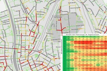
Traffic data for Mobility analysis & Traffic Planning
Use detailed traffic data from TomTom via WIGeoGIS for precise mobility analyses, traffic planning, and location analysis.

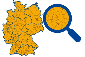
ZIP Code Map
ZIP Code maps are used to present topics in relation to location. We provide ZIP Code maps for your geo-analyses or as pure geometries for graphic artists. Also including market data upon request.

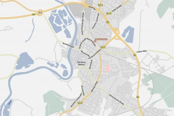
Road Data for Logistics and Fleet Management
Global road data from TomTom with comprehensive routing and navigation attributes—ideal for use in logistics, telematics, transport management, and freight forwarding.
Geodata: Test now free of charge and without obligation!
- Test data*: streets, traffic data, digital maps, boundaries
- Non-binding, free test
- Test ends automatically without cancellation
I will gladly support you, also by telephone.
* Information about the free test data: Selected test data is available for standard regions in Germany or Austria. For Germany, the data is for districts in Munich and the surrounding areas. For Austria, the data is for districts in Vienna and the surrounding areas. The products of WIGeoGIS are intended for companies and are not suitable for private use. If you need a one-time market analysis, we will gladly make you a service offer.

