Raiffeisen Banking Group: Geocoding, Penetration Analysis, Customer Acquisition
Raiffeisen Banking Group geocodes addresses throughout Austria with JoinAddress and relies on sociodemographic penetration data from WIGeoGIS. This allows addresses to be located on the map, customers to be geographically assigned to the appropriate branch, penetration analyses to be conducted, and new customers to be acquired.
Case Study Overview
Customer: Raiffeisen Banking Group (RBG)
Application: Geocoding of customer addresses with JoinAddress, demographics and market data
Product: JoinAddress, Demographic Data
Goal: Penetration analyses, assignment of customers to bank branches, market share assessment, customer acquisition, benchmarking, sales controlling
Use: All Raiffeisen locations in Austria (around 1,520) are included in a dedicated BI dashboard. 5 to 10 employees provide technical support for the JoinAddress solution in the Raiffeisen data centers.
4.4 million people trust in Raiffeisen banks
Raiffeisen Banking Group (RBG) is the largest banking group in Austria. 4.4 million people in Austria are Raiffeisen customers.
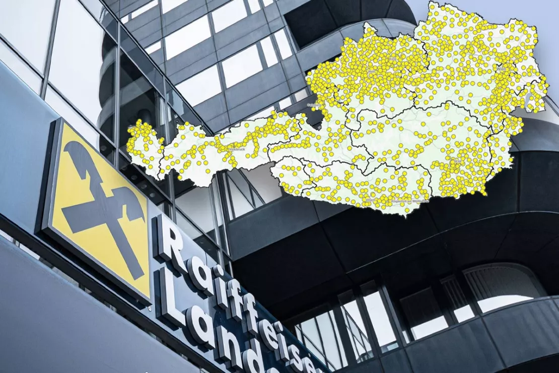
With more than 1,500 branches, the Raiffeisen Banking Group has the densest branch network in the country. This means you are sure to find a Raiffeisen bank branch nearby wherever you are in Austria. 26,800 employees are ready to serve the Raiffeisen customers.
Register now and test our geocoder for free.
How the Raiffeisen Banking Group Works with WIGeoGIS Products
The Raiffeisen Banking Group IT team developed an internal dashboard that incorporates the geocoding software JoinAddress and demographic data from WIGeoGIS as a strong foundation for data-driven analyses. This offers Raiffeisen employees several options:
- Display of customer distributions and market shares on a digital map
- Geographical assignment of (new) customers to bank branches
- Penetration analyses and market analyses
- Acquisition of new customers
- Assessment of key figures for sales controlling
- Comparison and benchmarking of Raiffeisen banks and bank branches
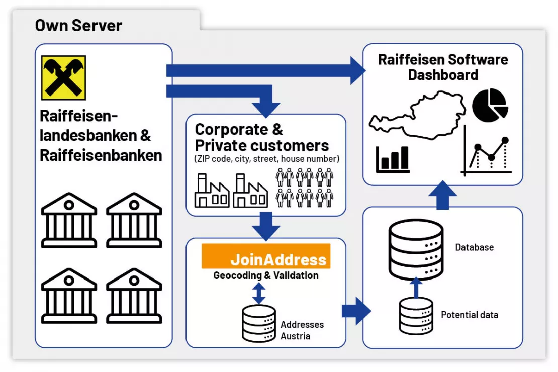
Image: Integration and workflow of the geocoder in the system landscape of the Raiffeisen Banking Group. JoinAddress, including the address databases, is operated in the Raiffeisen data center.
How does Raiffeisen benefit from the geocoder software JoinAddress?
When Raiffeisen bank employees enter or change the address of a new customer, this address is automatically enriched with information in the background by the geocoding software JoinAddress. This allows each address to be uniquely assigned to a statistical enumeration district. The statistical enumeration district is the smallest administrative unit in Austria and is also used by Statistics Austria to publish key figures from the register-based censuses.
This allows the internal data from Raiffeisen to be assigned to the potential data of Statistics Austria. “The statistical enumeration district level is used by numerous companies to conduct small-scale target group and market analyses,” explains Wolf Graf, Managing Director of WIGeoGIS.
“We use JoinAddress to locate customer addresses throughout Austria, in other words to assign them to a ZIP Code and a statistical enumeration district. The Raiffeisen regional banks and the branch offices work with dashboards that we provide. Using these dashboards, they can view this information in an aggregated form across multiple spatial levels.”
Tina Hiebl, Requirements Engineer at Raiffeisen Software GmbH
Employees can view the customer and market share distribution on a map and see how many customers they have in their catchment area. Strictly speaking, all new customer addresses are collected and sent through JoinAddress at the end of each working day. Of course, this also includes changing addresses for existing customers.
Software that is Easy to Configure
Another advantage of JoinAddress is the flexibility of the software. In order to take regional address-specific differences into account, there is no need to reprogram the JoinAddress server. Simply adjusting the configurations is enough. This helps reduce the workload. The Join Address geocoder, along with the address databases, are hosted in the Raiffeisen Software data center.
Test our geocoder with 400 addresses for free! Registration and testing are free. The trial period ends automatically.
Assigning Customer Addresses to Bank Branches
Since Raiffeisen has more than 1,500 bank branches in Austria, it is important that every customer is assigned to a branch near them.
Specifically, each customer is assigned to a statistical enumeration district, the smallest administrative unit. The statistical enumeration district, in turn, is assigned to both a bank and a bank branch. WIGeoGIS also provides the necessary statistical data.
“The Raiffeisen family in Austria is divided into statistical enumeration districts, which we assign not only to a single bank, but also to a specific bank branch, so that we can be even more granular. This allows us to see on a map where there are bank branches, where the respective customers live, and where we already have many customers. This also shows us where there is still a lot of customer potential, but there is not yet a bank branch or ATM nearby.”
Peter Baumgartner, Product-Owner Controlling at Raiffeisen Software GmbH
Penetration analyses and market analyses
In addition, the dashboard can be used to determine the market shares in the catchment area of each bank branch. This is possible because WIGeoGIS also provides data such as population numbers. Raiffeisen employees can also use the internal dashboard to find out how well they are represented within specific target groups.
Analyses of key indicators such as population, age, and purchasing power can serve as a basis for concrete action. Here, the age distribution of customers is particularly interesting: Where is Raiffeisen successful in attracting young customers, and where is there still potential to engage this target group more effectively?
Looking at the cross-selling rate can also provide valuable insight, for example, into how many products customers have on average per branch or catchment area. Is this rate above or below the group-wide average? What might be the reason if the cross-selling rate is below average? And how can it be increased?
Target Group Analysis and Customer Acquisition
The sales department also regularly runs special promotions to attract new customers, primarily in the corporate customer segment. Visualizing the addresses of potential customers and the related demographic data on a map is very helpful in this process. In order to capture the addresses of companies that are not yet Raiffeisen customers, they are manually geocoded using the JoinAddress Client. A target group analysis can then be performed based on the market data in the relevant catchment area.
Try Geocoder JoinAddress and geocode 400 addresses for FREE! Register now.
Austria-wide Benchmarking - A Quantum Leap in Sales Controlling
In 2021, before the group-wide introduction of the internal dashboard, fed with demographic data and potential data from WIGeoGIS and powered by the JoinAddress geocoder, benchmarking was much more difficult for the Raiffeisen Banking Group. The databases at individual bank branches applied different parameters to key figures. When introducing the dashboard, the Raiffeisen Banking Group defined uniform key performance indicators for all of Austria.
“With this project, the key performance indicators truly became comparable for the first time. Now we can benchmark each other based on various key performance indicators. With this system, and especially thanks to the statistical data also provided by WIGeoGIS, we have achieved a quantum leap in sales controlling. Now we can evaluate customer shares down to the statistical enumeration district level.”
Peter Baumgartner, Product-Owner Controlling at Raiffeisen Software GmbH
Why did Raiffeisen decide to work with WIGeoGIS?
Raiffeisen Landesbank Oberösterreich has been working with WIGeoGIS products for many years. In 2021, the system was rolled out across the entire group.
There were several reasons for deciding to trust in WIGeoGIS. An important factor was the ability to process and store data on internal bank servers. A cloud solution, like those offered by a number of competitors, was out of the question for Raiffeisen due to data protection concerns. The expertise and solution-oriented approach, as well as the quick and reliable accessibility of the WIGeoGIS team were also key factors.
“I am extremely happy with WIGeoGIS because follow-up questions are always addressed promptly and professionally. If there are any problems with the software, the colleagues at WIGeoGIS always respond promptly and have always quickly found a solution. It was also a top priority for us to ensure that our data remained in-house. Since we were very satisfied with the solution we had been using in Upper Austria for several years, we also decided to use JoinAddress and the penetration data from WIGeoGIS for our group-wide internal dashboard.”
Tina Hiebl, Requirements Engineer at Raiffeisen Software GmbH
Another key advantage is that all the WIGeoGIS employees can be contacted directly.
“We know all the contacts at WIGeoGIS by name and do not have to log into an anonymous ticket system whenever we have a problem.”
Peter Baumgartner, Product-Owner Controlling at Raiffeisen Software GmbH
Geocoding - further information
Geocoder Software JoinAddress
Find exact coordinates for your worldwide addresses from Excel files or databases. JoinAddress is smart, fast and stands out with its exceptional price-performance ratio.
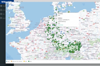
Geocoding: Information and Tips for Use
Here you will find background information, tips and insights into how companies use coordinates and geocoding for their business success.
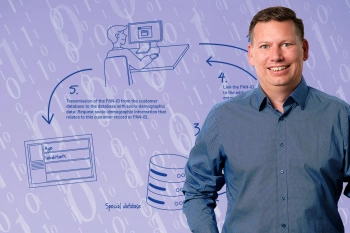
Geocoder Innovation: Marketing Tool from panadress with WIGeoGIS Technology
The DataCoder from panadress is a marketing tool for enriching microgeographic information that complies with data protection regulations.
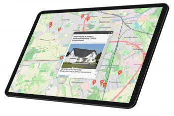
Finding Exact Geocoordinates: Real Estate Valuation at vdpResearch
vdpResearch creates over 600,000 valuations annually. They are based on coordinates provided by the JoinAddress geocoder.
JoinAddress: Fill out the form, test it free of charge & without obligation!
- Non-binding, free test*
- Test ends automatically without cancellation
- Geocode 400 addresses for free
* The products of WIGeoGIS are intended for companies and are not suitable for private use. If you need a one-time market analysis, we will gladly make you a service offer.
Request a free trial and try it now!

