Category Management and Assortment Planning with Geomarketing and GIS
Use geo-analysis to optimally adapt your product range to the local surroundings of your store locations. This is how you sell goods instead of blocking warehouse and shelf space with slow-moving items.
How can product ranges be planned to perfectly suit the location while simultaneously making optimal use of shelf space? Geomarketing provides the necessary data and analyses for informed decisions in category management. Those who understand market potential, target groups, and regional differences can precisely manage their product range, leading to measurable success. We will show you examples of how geomarketing and GIS can optimize your category management.
How Does Category Management with Geomarketing Work?
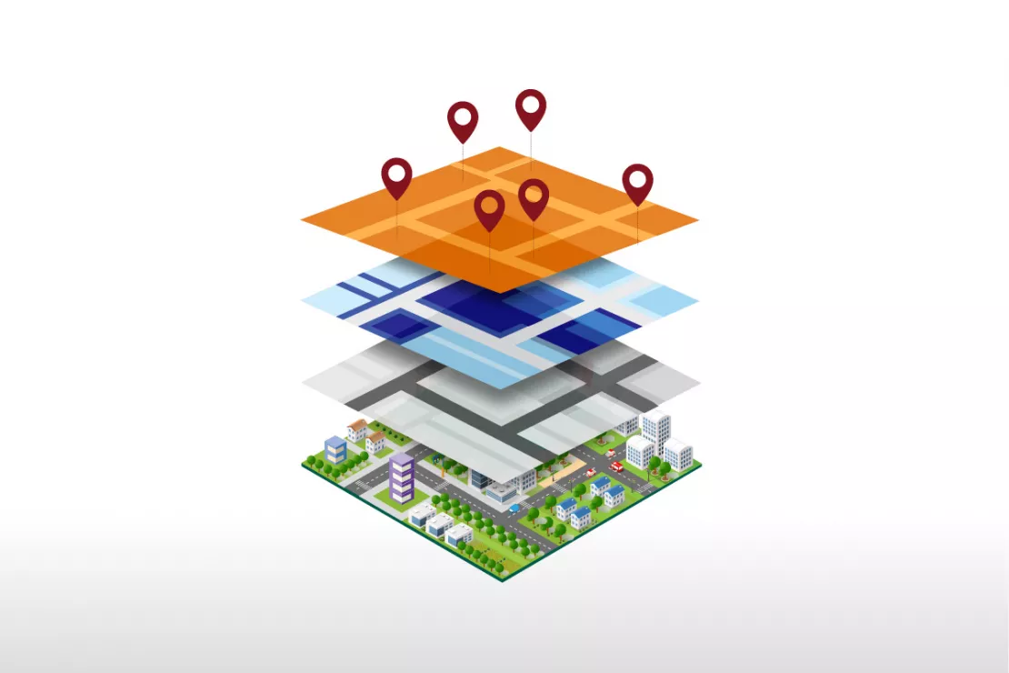
Geomarketing brings together aspects that are often considered separately in practice: location data, market potential, target groups, sales figures, and product range data.With the help of a WebGIS software like WIGeoWeb, category managers are able to spatially analyze this information. This enables them to make data-driven decisions about which products belong on the shelf at which location, and which do not.
An Overview of the Key Points:
- Geomarketing reveals regional differences in target groups, demand, and purchasing power.
- WebGIS software allows data from various sources (e.g., sales by product and category, sociodemographics, the competition) to be analyzed spatially and displayed on a digital map.
- Category managers recognize connections: Which products perform well in which catchment areas and why?
- Product ranges can be adjusted precisely and economically.
- WIGeoWeb is a powerful software solution for data-driven category management and assortment planning.
Would you like to learn more about how geomarketing and GIS software can support you with your category management? Simply contact us for more information!

Category management using geomarketing and GIS software: With digital maps and location data, you can find the right product range for every store location.
Here you will learn:
- Why are geomarketing and GIS ideal for optimizing product ranges based on location?
- How do I use geomarketing and GIS to help with my category management?
- Category Management: Practical Examples
- Which software supports location-based product range optimization?
- Case Studies: Category Management with Geomarketing and GIS
- Your contact: Arrange a free initial consultation with no obligation.
- FAQ
Why are geomarketing and GIS software ideal for optimizing product ranges and merchandise placement for specific locations?
Geomarketing and GIS software are particularly suited for questions relating to location. This is because they perfectly combine geodata, spatial analyses, and data-driven planning. When making location decisions, a precise analysis of the catchment area is essential, and this can only be done comprehensively and accurately with geomarketing and GIS.
How do I use geomarketing and GIS to help with my category management?
Geocoordinates, data, and WebGIS software that allows analysis on digital maps: that is geomarketing. We will show you how to use tools and methods for your inventory management.
For category management with geomarketing, you need:
- GIS software, such as WIGeoWeb
- In-house company data,
- Geodata
- Demographic data and purchasing power data for your target group
- Information and location data
This allows you to analyze each location individually and learn how to optimally organize your product range and merchandise placement in every store location.
Do you have questions about category management and assortment planning with the support of GIS software? We have the answers!
Category management with GIS software step by step:
- Geocoding: In the first step, addresses of locations are automatically converted into coordinates via geocoding and displayed on a digital map.
- Define the catchment area: A catchment area is calculated around the location, either automatically or individually defined. You decide how far this area should extend and how customers typically reach it: on foot, by bicycle, by public transport, or by car, depending on your business model.
- Integrate your own company data: You upload your internal data into the WebGIS software, e.g., sales by product and product group, and assign it to the respective location.
- Add external data: You add geospatial market data, such as general or product-specific purchasing power, age structure, or household size in the catchment area.
- Analysis of the catchment area and a data-driven decision: You analyze the catchment area to precisely define the local target group. In combination with internal sales figures, a more nuanced picture emerges, providing you with data-driven insights and enabling you to make informed decisions.
Geomarketing analyses provide answers to the following questions, among others:
- Why do certain products perform poorly at a particular location? Is it the product itself, or perhaps the packaging size because of the high number of one- or two-person households in the area?
- Which products should I include in my product range because they fit the target group structure in the catchment area?
- In which markets can the product range be streamlined because certain product groups do not generate relevant demand and there is no potential in the catchment area?
With GIS analysis, you can identify untapped potential, reduce misinvestments, and utilize your shelf space more efficiently.
“For example, clear correlations can be identified in data between age structure, housing type, and product affinity. Such insights can be used to precisely tailor product ranges to the customers in the vicinity of each store location. This allows chain stores to meet their customers' needs and demands much better, while simultaneously avoiding expensive overstock, slow-moving items, and misinvestments in the wrong product range.”
Thorsten Lange, Merchandising and Spatial Intelligence
Do you want to make better, data-driven decisions regarding product range and space utilization? Category management with geomarketing can help!
Category Management: Practical Examples
What does category management with geomarketing look like in practice? Let us show you with two examples!

Example 1: Pharmacies
Pharmacies often have a space problem. The sales area and display space must be used optimally. The stockroom is overflowing. This is often due to a product range that is not optimized for the specific location and needs of the customers in the area. This is because most pharmacies base their product design solely on their regular customers and their inventory management system. This has the (negative) consequence that:
- They do not know the needs of the people who pass by their pharmacy every day because there is nothing to entice them to come inside. Pharmacies are thus missing out on a lot of potential.
- They only offer the products they already sell. They do not know which goods they could have sold (better).
That is exactly what pharmacies learn through geomarketing analyses.
“Pharmacies usually manage their product range by weeding out slow-moving items and focusing on their regular customers. They neglect the potential of the catchment area. A product range tailored to the needs of the location offers great opportunities: increased sales, optimal stock levels and availability, and cost reduction.”
Wolf Graf, Managing Director, WIGeoGIS
With geomarketing and GIS, pharmacies can...
- Tailor their product range to the needs of the location: Population information such as age and purchasing power, competitors, doctors, and footfall generators like supermarkets and shopping centers provide information about the structure of the location and its surroundings. Is it primarily a residential area or are there many offices? Do more families or single people live in the area? Are my potential customers older or younger? How much do they earn? What is their education level? This allows pharmacies to draw conclusions about the required products, health needs, and self-medication behavior.
- Optimally manage their product range and presentation: The local surroundings are constantly changing. While a few years ago families with children were in the majority, now older couples are more common. Pharmacies should therefore adjust their product range, their placement in the sales area, and their window displays accordingly.
- Offer improved availability of prescription medications: Geomarketing analyses show which medical specialists are located in the vicinity of the pharmacy. This provides pharmacies with information on which medications are frequently prescribed and allows them to stock prescription medications and supplements accordingly. This not only leads to optimized stockroom management, but also to increased customer loyalty, as they appreciate having their medications readily available.
When is it particularly worthwhile for pharmacies to use geomarketing and GIS?
It is particularly worthwhile for pharmacies to use geomarketing during the initial setup or when taking over another pharmacy. Analyses using GIS software also help with continuous optimization. This is necessary because it is becoming increasingly difficult for pharmacies to remain profitable. When pharmacies correctly implement the results of geomarketing analyses, this contributes to strengthening customer loyalty, increasing impulse purchasing power, and boosting sales. Pharmacies have less tied-up capital because they are able to reduce their inventory.

Example 2: DIY Store
DIY stores often carry a wide range of products, but not always tailored to their target audience. Many DIY stores rely on a standardized product range, regardless of whether they are located in a large city or a rural area.
This results in products that are hardly in demand locally blocking shelf space, while other product groups are understocked.
The problem: Assortment planning is often based on historical sales figures or central guidelines, without taking local demands into account. What is missing is a targeted comparison with local conditions: age structure, housing type, purchasing power, and how customers actually use the store and its products.
Geomarketing closes this exact gap.
“Many retailers underestimate the potential of a regionally differentiated product range. If you know exactly how people live in the area surrounding your DIY store, you can tailor your product range much more effectively to your customers’ needs. This increases customer satisfaction, reach, and market penetration, because if customers cannot satisfy their needs in their chosen retail outlet, they will go elsewhere, locally or online.”
Thorsten Lange, Merchandising and Spatial Intelligence
With geomarketing and GIS, DIY stores can:
- Adjust product ranges to specific locations: Using geodata and market data such as age, housing type, and purchasing power, category managers are able to recognize what is in demand in urban areas and in the local surroundings, and can also adapt color schemes and wood types that match the tastes of each location.
- Optimize product placement: Retail space is valuable. If you are able to recognize which product groups perform well locally, you can increase sales per square meter and remove unnecessary products from your assortment.
- Unlock sales potential: By overlaying internal sales data with external market information, DIY stores can, for example, determine where higher-priced branded products or cheaper private-label brands should be better positioned based on the socioeconomic characteristics of the local surroundings.
When is it particularly worthwhile for DIY stores to use geomarketing and GIS?
Geomarketing offers decisive advantages, especially when realigning individual markets, launching new product lines, and optimizing inventory. Category managers can make informed, data-driven decisions tailored to regional target groups and market potential. This leads to greater shelf relevance, higher sales per square meter, and noticeably more efficient assortment planning.
What are the advantages of category management with geomarketing for my company? Simply contact us. We will be happy to discuss it with you!
Which category management software specifically supports assortment and merchandise optimization by location?
The WebGIS software WIGeoWeb is an ideal solution for category management with geomarketing.
Why? WIGeoWeb makes it possible to analyze and specifically combine internal and external data and to display the results on a map without the need for any prior GIS knowledge. Category managers, store managers, sales and service representatives work with a shared web-based platform (hosted in the EU) to analyze catchment areas, target groups, and market potential, and to manage product ranges on a location-specific basis. WIGeoWeb supports remote work, can be used on mobile devices and tablets, and can be flexibly adapted to your company needs.

With the WIGeoWeb software, service representatives can collect data in the field, for example, about competitor locations. This makes even more precise analyses possible.
These Companies Rely on WebGIS Software and Solutions from WIGeoGIS

Raiffeisen Banking Group: Geocoding and Penetration Analyses
The Raiffeisen Banking Group uses JoinAddress to geocode addresses across the entire group and relies on demographic data from WIGeoGIS for penetration analysis and customer acquisition.

Intersport: Location analyses for retail
The world’s largest dealer network has relied on WIGeoGIS’s geomarketing software in Germany for several years already.

Case Study STIHL
The manufacturer of chainsaws and tools for the construction industry and gardening and landscape maintenance uses the location analysis software WIGeoLocation for the development of its retail network and advertising material planning.

Case Study: Lotto Baden-Württemberg
Lotto Baden-Württemberg relies on the geo tool WIGeoLocation and data from WIGeoGIS for location analyses and location planning. This allows the betting provider to successfully further develop its network of locations.
Category Management with Geomarketing: Request a free initial consultation
- FREE initial consultation on Category Management with Geomarketing and GIS
- Non-binding, without further obligations
- By telephone or video call
Do you want to optimize your product range to suit your location? I will gladly support you. Please contact me!

* The products of WIGeoGIS are intended for companies and are not suitable for private use. If you need a one-time market analysis, we will gladly make you a service offer.
FAQ
-
What specific benefits does geomarketing bring to category management?
WebGIS software like WIGeoWeb allows you to analyze your catchment areas, identify target group profiles, and combine internal sales data with external market data such as purchasing power and demographics. This creates a solid foundation for well-informed, data-driven decisions about which product groups are truly in demand at which location. This in turn results in more precise assortment planning, less excess inventory, and higher sales per square meter.
-
Is there a practical example of category management with geomarketing?
Yes! For example, pharmacies and DIY stores use geomarketing to target their product ranges to specific customer groups. Pharmacies adapt their product range, for example, to the age and health profile of the population in their catchment area. DIY stores analyze housing types, age structure, and purchasing power in order to offer, for example, balcony solutions in cities or garden equipment in suburban areas. These examples of category management demonstrate how local analyses can be used to optimize your product range and shelf placement.
-
Which software is suitable for location-specific product group management and assortment optimization?
For category management with geomarketing, we recommend the WebGIS software WIGeoWeb. It allows you to analyze and visualize internal data (e.g., sales figures by product group) together with external geodata (e.g., purchasing power, demographics), directly on a digital map. The software is web-based, intuitive to use, supports remote work, and can be flexibly adapted to the requirements of retail companies.
-
What data do I need for category management with geomarketing?
For effective, location-specific category management, you need a combination of internal and external data. This includes internal sales figures by product and product group, location addresses, and store layout plans. This data is supplemented by external market data with geospatial information, for example, purchasing power, age structure, household size, housing type, or competitive density in the catchment area. WIGeoGIS offers such geo- and market data.