Geomarketing Helps Omnichannel Retail
Omnichannel has long been state of the art, as consumers expect seamless shopping experiences across all sales channels. Geomarketing and GIS systems help overcome the challenges of omnichannel retail. They make touchpoints spatially visible and enable precise analyses that serve as the basis for well-founded measures.
How Do Geomarketing and GIS Solutions Support a Successful Omnichannel Strategy?
Geomarketing and GIS (geographic information systems) play a central role in the implementation of effective omnichannel strategies. They enable companies to link location-based data with customer behavior, purchasing power, market potential, and logistical information. These insights help to better integrate sales channels, more specifically target marketing measures, and optimize the customer experience across channels precisely where it is needed. This makes omnichannel not only technically possible, but also economically successful.
How can geomarketing help master omnichannel retail? Let us show you!
GIS & Geomarketing support your omnichannel strategy with:
GIS Software Answers These Questions for Omnichannel Retail
- Where can I achieve high sales and revenues in online retail? Where in the retail business? Am I taking full advantage of my potential?
- Where are there a lot of returns in online retail and where is the highest demand?
- In which areas are there often searches for my products?
- For which stores do customers check product availability online?
- What type of consumers are my online buyers? This allows advertising measures to be optimally aligned with the usage habits of the target group.
- In which stores are Omnichannel services (Click & Collect, online product availability check, in-store return, in-store order) used most?
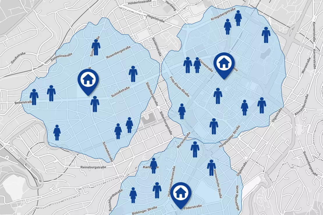
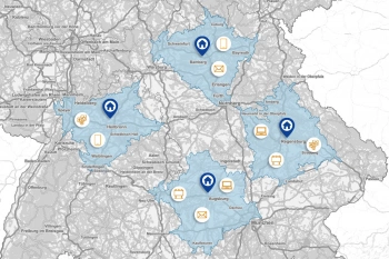
With catchment areas, as shown in the picture above, geomarketing answers the questions: How many people live in the area surrounding the location? What characteristics, such as age structure, purchasing power, etc., do these people have?
Would you like to use geomarketing and GIS for your omnichannel strategy? We are happy to help you!
Omnichannel: State of the Art with Challenges
Omnichannel has long been state of the art, as consumers expect seamless shopping experiences across all sales channels. Retail groups and brand owners have recognized this change and are investing in appropriate structures. During this process, they face three central challenges:
- Developing a long-term strategy for the integration of all sales channels
- Gaining a deep understanding of customer behavior
- Effectively using existing data and useful analyses and visualizations to answer omnichannel questions
This is exactly where GIS systems come in: They make customer activities visible spatially and enable precise analyses that provide the basis for well-founded decisions in omnichannel management.
Channel Integration
Channel integration is one of the top challenges. One reason for these difficulties is that retail companies can not fully analyze the behavior of their customers across the different channels. This is because common data analyses are not able to effectively visualize actions and purchases. Therefore, about half of the retail companies worldwide plan to invest in extensive data analytics and in the increased analysis of customer data. GIS systems answer questions that are highly relevant to omnichannel retail and display the answers on a map.
- Where do customers shop?
- Where online, where offline?
- Where do they return merchandise?
- Where do they buy a lot, where not so much?
- Where are the highest affinities for online and offline purchases?
- Where are offers such as Click & Collect frequently used?
Questions such as these, which take location into account and have a geographical component (stores, delivery addresses, billing addresses, store finder searches) can not be ideally visualized in tables and diagrams. However, geomarketing and GIS software can! It can optimally analyze such data with spatial reference and visualize customer behavior on digital maps.
Would you like to know how geomarketing and GIS can help you with your channel integration? We are happy to explain it to you.
Understanding Customer Behavior Across Channels
“GIS systems are particularly suitable for data analysis in the omnichannel sector. Spatially aggregating company data and putting it in relation to market data is extremely helpful. Customer activities are clearly visualized on maps, providing information such as where customers shop in brick and mortar stores, where they shop online, where they use which omnichannel services, where there are a high number of returns, etc. This allows retailers to draw important conclusions for the development of their channel strategies,” explains Wolf Graf, Managing Director of WIGeoGIS.
WIGeoGIS helps a large number of retailers analyze their sales, market, competition and customer data geographically. For example, the ANWR GROUP and INTERSPORT rely on the WebGIS software from WIGeoGIS for location analysis, and media planners for omnichannel strategies.
Data Analysis and Omnichannel
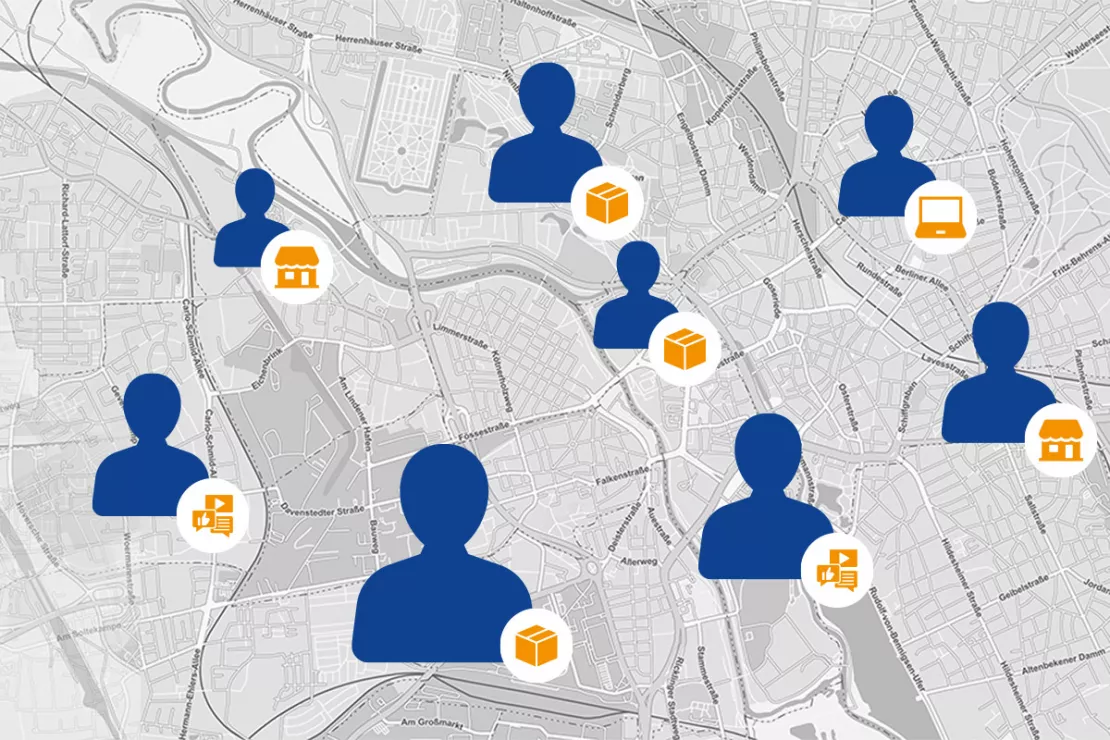
In order to best coordinate online sales, in-shop sales and omnichannel services, retailers and brand manufacturers analyze geographic data from location finders, web shops, online inquiries and offline sales.
- Which sales and communication channels do customers tend to use?
- Where do customers use which omnichannel services, for example, Click & Collect, in-store returns, and the like?
The results of the geomarketing analyses flow into the planning of marketing campaigns and branch locations. A successful channel interaction strategy can thus be developed.
How to Optimally Use, Analyze, and Visualize Data
With WIGeoWeb, WIGeoGIS provides a comprehensive, browser-based WebGIS that enables all the employees involved in the Omnichannel process to work collaboratively. The software is user-friendly and provides standardized geomarketing analysis and queries. Data can be uploaded directly to WIGeoWeb (e.g. as an Excel table) or imported via interface from all common CRM and BI systems.
For GIS experts, WIGeoGIS offers extensions for QGIS and ArcGIS.
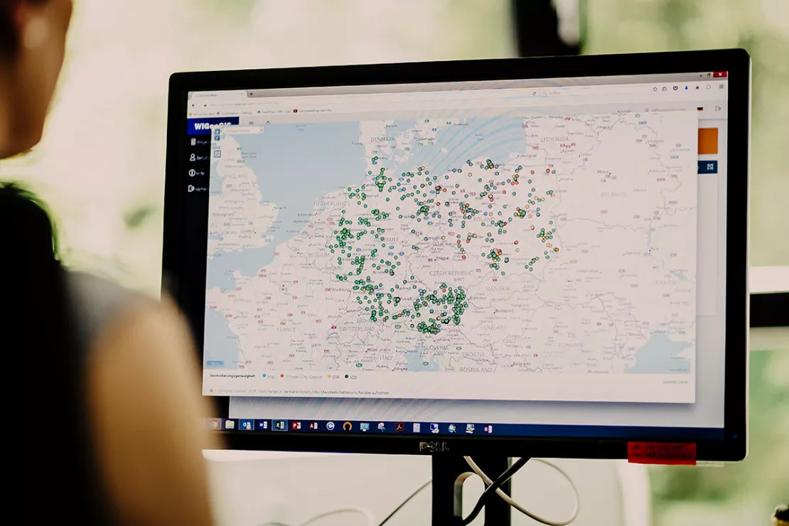
The first step in geomarketing is geocoding. In this case, the geocoder software assigns geocoordinates to each address enabling them to be located and displayed on a map. The addresses that you geocode, for example addresses from customer cards, addresses of your online buyers or online returns etc., can then be displayed on a map. This allows you to see at a glance where a large number of online purchases or returns are made. A subsequent GIS analysis provides you with a comprehensive picture of your customers allowing you to know WHERE they do WHAT. You gain new insights that were previously buried under mountains of data and columns of numbers.
Test Geocoder JoinAddress Web for free!
Take your addresses from an Excel list and display them meaningfully on a map. Try geocoding for yourself. Simply register and geocode 400 customer addresses free of charge. And just like that you have taken your first step in geomarketing.
This could be relevant for you:
Location Analysis in Retail
Location analysis is still crucial in retail. We offer the know-how and the tools to ensure you make successful decisions for your business locations.
Using Geomarketing Successfully in Media Planning
More targeted campaigns, less wastage, more satisfied customers: Discover how modern media planning with WebGIS tools and geodata sets new standards, including practical examples and application tips.

Customer Journey Data Germany
The data provides insights into the interaction and purchasing behavior of German consumers. Most importantly, it tells you WHERE and how can you reach your target groups.
Data on Online Affinity and Online Purchasing Power
Data on internet usage are now essential. Retailers can use this data to localize target groups and estimate their market potential in online and brick and mortar retail.
Omnichannel Retail: Request a free initial consultation
- FREE initial consultation on Omnichannel Retail
- Non-binding, without further obligations
- By telephone or video call
Do you want to know more about Omnichannel Retail? I will gladly support you. Please contact me!
FAQ
-
How can geomarketing and GIS systems support omnichannel retail?
Through the targeted use of geomarketing and GIS technologies, retailers and manufacturers of branded goods can master the complexity of omnichannel retail. GIS tool allows you to:
- Precisely analyze customer behavior spatially
- Optimally link sales channels
- Make data-based decisions
This not only increases customer satisfaction but also sustainably secures competitiveness in the dynamic retail environment.
-
What are the prerequisites for successful omnichannel strategies?
The development of a cross-channel strategy requires cross-channel thinking and analysis systems within the company. Retailers who already provide or plan to offer omnichannel services are ideally supported by a WebGIS system, both in the planning phase and in the operational business. WIGeoGIS customers mostly use the WebGIS software WIGeoWeb. The system is browser-based, easy to use and customizable for the individual company.
-
How does the restaurant industry use WebGIS software and geomarketing for omnichannel strategies?
Chain restaurants use all their order requests to plan new locations, re-design their delivery areas and determine the orientation of their branches. As a result, some new locations are no longer restaurants, but only kitchens that cook for the delivery service. For the expansions, those online inquiries that can not be served play a particularly important role. Restaurants are thus able to specifically open branch locations in the areas with the highest demand.

