Location Analysis with the Help of Artificial Intelligence
How WIGeo Location Atlas Uses Artificial Intelligence and Machine Learning to Enhance Location Analyses to Make Selecting Your Location Easier
Why Location Analysis is the Key to Your Success
The following applies in brick-and-mortar retail as well as in the gastronomy and service industries: Location is the most important prerequisite for the success of your company. A well-chosen location with a forward-looking concept is a competitive advantage that is difficult for the competition to imitate.
One way to the perfect location is via WIGeo Location Atlas, which can be used to search cities, municipalities and regions for different sales-oriented location factors. It helps you to quickly find the quarters and streets that are best suited for your business.
WIGeoGIS spent three years developing WIGeo Location Atlas and built machine learning models for it that were trained with millions of pieces of data. Now you can quickly identify those areas that best match your location factors.
How do you find the optimal region for new locations?
With WIGeo Location Atlas you can quickly find out:
- Where in a region which commercial focal points and trendy districts are located
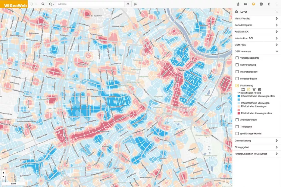
- Where there are more chain stores and owner-managed businesses
- Where there are more quality locations with exclusive shops, more consumer locations and more simple locations
- Where there are shops with large (or small) sales areas
- Where the major and minor centers of a city or municipality are located
Vienna: The main shopping streets (in red) are easily recognizable by the high density of chain stores.
Try out location analysis with WIGeo Location Atlas now! Get your free trial access now!
What is special about the Location Analysis in WIGeo Location Atlas?
You select the location factors that are important for your business and WIGeo Location Atlas searches for those road sections that meet your individual requirements for an ideal location. The result is displayed using colored heatmaps, similar to those used in weather forecasting. This allows you to see at a glance which area makes the most sense for you to look for a suitable store location!
You can also check existing locations with WIGeo Location Atlas: This allows you, based on data, to quickly recognize if the area around a location, and thus the clientele, has changed and the choice of location is no longer optimal.
The WIGeoGIS team has been working on the development of WIGeo Location Atlas for three years, raising location analysis to an unprecedented level! Artificial intelligence and machine learning processes played an important role here, as well as the experience, expertise and passion of the WIGeoGIS developers.
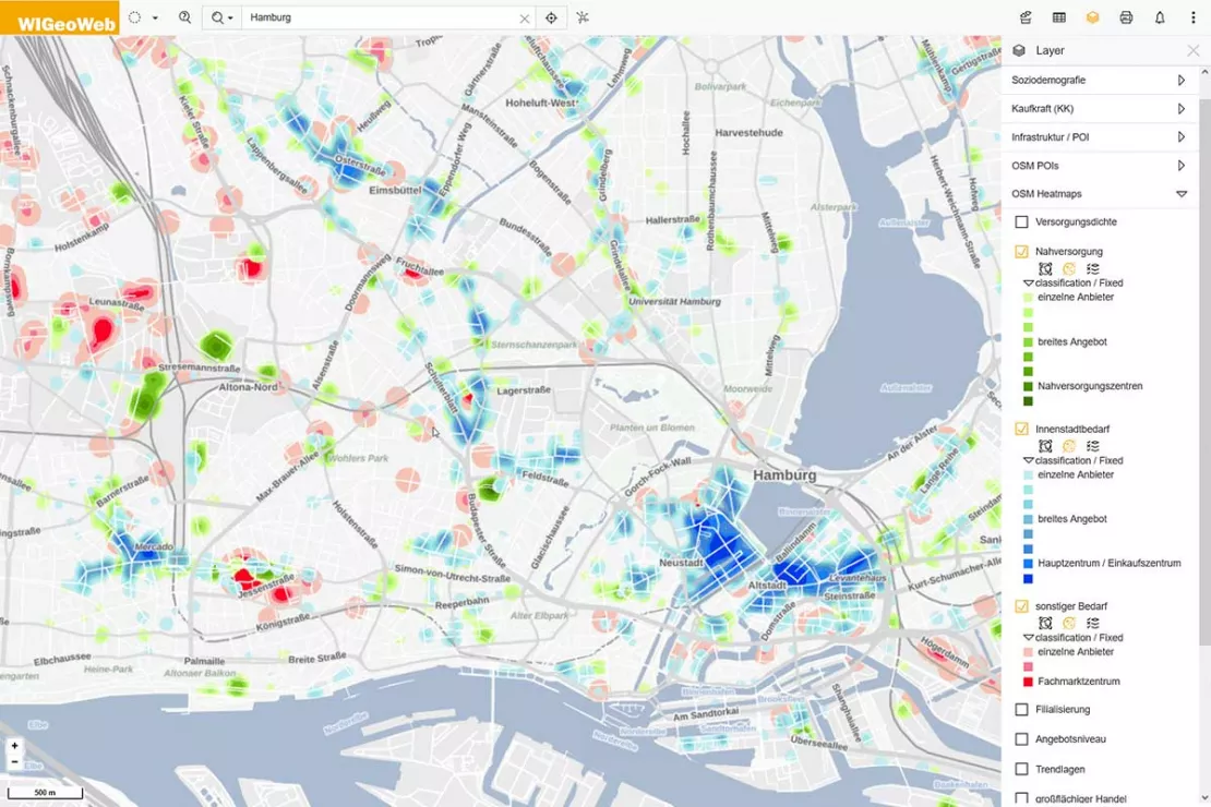
Hamburg: The typical downtown locations (in blue) can be found mainly in the city and in the district centers. Local supply centers (in green), on the other hand, are spread across the entire city within easy walking distance and close to where people live. Preferred locations for large retail stores (in red) tend to be in commercial areas.
Location Selection Made Easy
“Birds of a feather flock together is also true in retail,” says Marc Urner, Key Account Manager at WIGeoGIS, about the WIGeo Location Atlas. “You won't find a Hermes parcel shop in a luxury mile, instead you will find a Hermès Paris. We therefore wanted to enable our customers to understand at a glance what makes a city or community tick, where the main center is, where the secondary centers are, what makes these shopping locations stand out and what kinds of locations are available.”
With WIGeo Location Atlas, it is now possible to get a quick overview of the nuances in the micro-location. Urner: “For example, retail companies can quickly see on the digital map which places are best for their branch locations. In this way, we take location analysis to a new level.”
Try WIGeo Location Atlas for free. Get your free trial access now!
What data is the location analysis with WIGeo Location Atlas based on?
WIGeo Location Atlas is based on publicly accessible information from the digital world map OpenStreetMap (OSM). This is a freely usable collection of geodata in which so-called points of interest (POIs) are collected and entered.
A POI corresponds to a single point on a map and is a simplified image of the corresponding real-world object.
How many POIs does WIGeo Location Atlas include for the location analysis?
From the more than 3 million POIs contained in OSM, 1.4 million retail-relevant data records for Germany, Austria and Switzerland were preselected. These POIs can be assigned to the relevant core sectors (retail trade, automobile trade, wholesale trade, retail-related services, gastronomy and accommodation).
In addition, WIGeo Location Atlas contains POIs from the areas of government and administration, education, social affairs, health care, leisure and sports, culture, religion, public transport, sights, trade and industry and business services.
What are typical Points of Interest (POIs)?
- Retail locations and retail-related services
- Restaurants, accommodations, ATMs
- Gas stations, multi-story car parks, garages
- Doctors, clinics, pharmacies
- Sights and recreational offers such as leisure and cultural facilities, for example museums, cinemas and sports facilities
- Public institutions from administration, education and culture, as well as health and social services
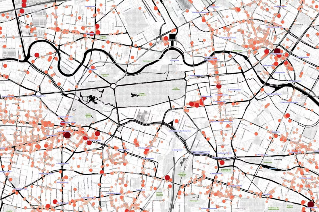
Berlin: The allocation of POIs to retail chains and subgroups made it possible to determine the average sales area for each type of business.
Would you like to try out Location Analysis with the WIGeo Location Atlas? Request your test account for free with no obligation.
About the Development of WIGeo Location Atlas
Objective
WIGeo Location Atlas is a uniform data product for Germany, Austria and Switzerland that contains different sales-relevant location factors at the street level and presents them in a way that is clear and understandable. Here is a summary of how this product came to be.
Phase 1: OpenStreetMap (OSM) as a basis
OpenStreetMap (OSM) is a great data treasure. The POIs are entered into OSM by no fewer than eight million voluntary “mappers” worldwide and enhanced with additional information. As a result, the data, similar to the knowledge platform Wikipedia, is naturally not always 100 percent consistent. Depending on how active the local OSM community is, not all POIs are equally complete and up-to-date.
Phase 2: Categorization
A comprehensible categorization of the individual points of interest is particularly important for WIGeo Location Atlas in order to obtain the relevant location factors. The OSM categories assigned by the “mappers” form a good basis, but there was still a lot of detail work to be done in order to offer WIGeoGIS customers real added value.
“Although the data in OpenStreetMap is very well structured, there is a certain lack of categorization. For example, one OSM mapper classifies a business as a hairdresser, another sees it as a beauty salon,” says Marc Urner, WIGeoGIS Key Account Manager
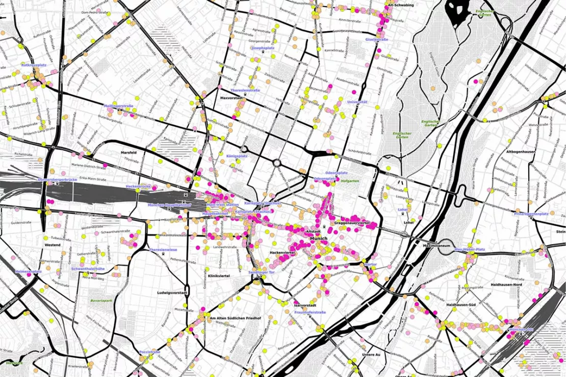
Munich: Birds of a feather flock together: International chain stores (in Pink) prefer prime locations and pay corresponding shop rents.
Phase 3: Machine Learning and Artificial Intelligence
WIGeoGIS developed a reference database with location-relevant categories and then programmed an artificial intelligence (AI) to mostly recognize which POI should be assigned to which categories based on semantic patterns. This information served as training data for the newly developed machine learning model.
Phase 4: Human in the Loop
“Of course, we had to make improvements before the artificial intelligence became accurate. In this way, we finally succeeded in deriving very precise location factors from the raw POI data,” says Marc Urner about the need for human intelligence.
On the one hand, the raw data is not always 100 percent correct. On the other hand, the AI can also make “mistakes”: For example, if a drugstore chain has the same name as a bakery, the AI may turn the bakery into a drugstore.
That is why machine learning processes always need the “Human in the Loop” who checks the data and the assignments made by the AI and, if necessary, intervenes to correct them. This allows the computer to learn and thus become better and better.
Result:
“It was not easy to put this puzzle together. First of all, we had to develop a category structure that does justice to the questions in geomarketing on the one hand, and to the usual logic in retail on the other hand. In the end, it is about using the information obtained to actually answer the typical questions for retail or urban development reliably,” summarizes Marc Urner.
During the three-year development of WIGeo Location Atlas, Marc Urner and his colleagues observed how the data set became more and more meaningful, so that today the final data product is available for use in location analysis.
Try out location analysis with WIGeo Location Atlas for FREE with no obligation!
Benchmark for Your Location Selection: WIGeo Location Atlas
In order to ensure the greatest possible benefit for WIGeoGIS customers, the POIs were assigned to around 300 categories during development. For these categories, WIGeoGIS used common industry-specific terms from retail and official statistics.
WIGeo Location Atlas assigns the individual companies to the branches retail, wholesale, automotive trade, retail-related services, gastronomy and the accommodation, and further differentiates between 40 assortments, approximately 100 assortment groups and 230 subgroups depending on the type of goods sold.
The result is sales-oriented location factors for the entire DACH region:
- Shops differentiated according to business types: branch establishments vs. owner-managed businesses
- Stores are differentiated by area structure: estimated average sales area in square meters
- Product groups are differentiated according to purchase frequency, i.e. the frequency of their purchase: e.g. periodic needs, i.e. basic necessities for local supply and consumer goods with high purchase frequency such as baked goods, meat and sausages, groceries, luxury foods, drugstore items, cut flowers, etc. versus aperiodic needs, i.e. consumer goods with medium to long-term procurement rhythm such as clothing, shoes, photos, watches, jewelry, consumer electronics, furniture, etc.
- Goods are differentiated according to center relevance: Local supply needs (e.g. bakeries, kiosks, drugstores), downtown needs or needs that are not relevant to the city center (e.g. specialist stores, furniture stores, car dealerships, gas stations, types of business with automobile customer orientation on major access roads and arterial roads, on the outskirts and in the countryside)
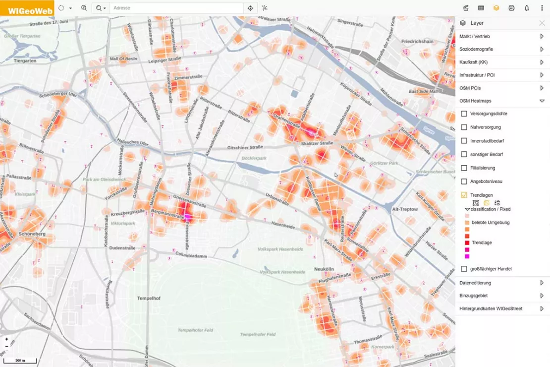
Berlin: Hip, hipper, Neukölln: The current Berlin hot spot of gentrification has changed from a social hot spot to a nightlife and promenade.
The categorized data form the basis for the evaluation of cities, streets, districts and quarters on interactive maps: There you can see at a glance which target areas best meet the location factors relevant for you. The detailed categorization of the POIs is therefore the prerequisite for the clear presentation of the results relevant to your requirements.
“We have refined the data from OpenStreetMap with our categorization and made the wealth of data easier to interpret. In addition to the OSM main categories, we have added suitable subcategories, for example men’s/women’s fashion or organic shops/organic supermarkets. A data set like OpenStreetMap is never complete, but it is very informative due to the large number of POIs,” says Marc Urner about the benefits of WIGeo Location Atlas.
If the standardized maps do not 100 percent answer the questions for your individual location analysis, we can perform more detailed surveys individually for you. For example, it would be possible to highlight all the Italian restaurants. If you require it, the experts from WIGeoGIS are happy to provide consultation!
Get to know Location Analysis with the WIGeo Location Atlas now! Request your free test account now!
These Companies Rely on WIGeoGIS for Location Analyses
More Case Studies

Case Study: Lotto Baden-Württemberg
Lotto Baden-Württemberg relies on the geo tool WIGeoLocation and data from WIGeoGIS for location analyses and location planning. This allows the betting provider to successfully further develop its network of locations.
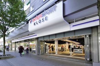
Intersport: Location analyses for retail
The world’s largest dealer network has relied on WIGeoGIS’s geomarketing software in Germany for several years already.
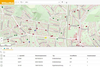
WIGeoWeb in Real Estate Appraisal
For example, Real(e)value enhances its proven, high-performance real estate appraisal tool by spatially representing the data using WebGIS.
Location Analysis with Artificial Intelligence: Request test access!
- FREE test access*
- Non-binding and free of obligation
- Consultation by phone or video call
Do you want to know more about location analysis with WIGeo Location Atlas? I will gladly support you. Please contact me!
* Information about the free test access: Standard regions with selected data in Germany or Austria will be made available. In Germany, these regions are districts in Munich and environs, and districts of Vienna and environs in Austria. The products of WIGeoGIS are intended for companies and are not suitable for private use. If you need a one-time market analysis, we will gladly make you a service offer.
FAQ
-
Which location factors does WIGeo Location Atlas display?
WIGeo Location Atlas displays location factors for locations, transport links, infrastructure and sales opportunities across the board for Germany, Austria and Switzerland.
-
How can I use WIGeo Location Atlas?
WIGeo Location Atlas is a uniform data product for Germany, Austria and Switzerland that contains different sales-relevant location factors at the street level and presents them in a way that is clear and understandable. You can use the data in your GIS system or online with WIGeoWeb or WIGeoLocation.
-
How does OpenStreetMap support location analysis in WIGeo Location Atlas?
OpenStreetMap (OSM) is a great data treasure. The Points of Interest (POIs) are entered into OSM by no fewer than eight million voluntary “mappers” worldwide and enriched with additional information. As a result, the data, similar to the knowledge platform Wikipedia, is naturally not always 100 percent consistent. Depending on how active the local OSM community is, not all POIs are equally complete and up-to-date.
A comprehensible categorization of the individual POIs is particularly important for WIGeo Location Atlas. The OSM categories assigned by the “mappers” form the basis of WIGeo Location Atlas.
-
Are the POIs in OpenStreetMap complete?
No, but that is not necessary. The data is so extensive and covers all areas broadly. Machine learning is used to determine the general character of a store location, which is then displayed on a digital map. Heat maps, also known as density maps, show the spatial concentration of different location factors, be it business types, shopping locations or sales areas.

