WIGeoStreet – High-Precision Vector Maps for GIS Applications
Use high-quality vector maps based on TomTom Multinet-R for your GIS projects. WIGeoStreet provides detailed layers for roads, boundaries, POIs, and land use – optimized for ESRI, QGIS, and other common GIS software.
WIGeoStreet – Precise GIS Vector Maps Based on TomTom Multinet-R
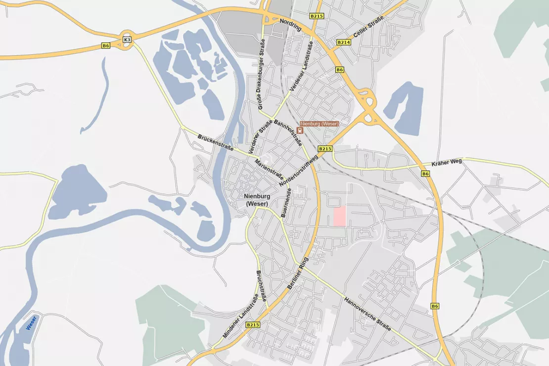
WIGeoStreet is a professional vector map product designed for demanding GIS applications. Based on the high-quality TomTom Multinet-R data source, WIGeoStreet provides detailed geographic information for Europe and selected regions worldwide. With over 22 layers – including road networks, administrative boundaries, land use, and POIs – the product offers a reliable basis for GIS use. Delivered in ESRI File Geodatabase format and as GeoPackage for QGIS, WIGeoStreet is immediately ready for flexible use.

WIGeoStreet – Digital Vector Maps
- Product: WIGeoStreet – Digital Vector Maps
- Standard Format: ESRI File Geodatabase or GeoPackage
- Source: TomTom Multinet-R
- Layers: 22 main layers including administrative boundaries, land use & built-up areas, cities & municipalities, road networks & transport infrastructure, water bodies & natural areas
- Visualization: Layer files enable easy loading and immediate display in GIS systems
- Update Cycle: Annually
- Data Reference Year: 2025
- Coverage: Europe and selected countries worldwide
Explore WIGeoStreet in your GIS environment today.
WIGeoStreet – Data Description
WIGeoStreet includes numerous layers of digital information.
Point Data: Facilities & Locations
- Points of Interest (POI): Categorized into three levels of importance, with attributes such as name, type, and relevance
- Cities & Municipalities: Structured by size and significance
- Motorway Access Points and Junctions
Line Data: Boundaries & Roads
- Administrative Boundaries: Available as line layers
- Road Network: Includes all road classes, one-way streets, pedestrian zones
- Railway Network
- House Number Ranges: For precise address geolocation
Area Data: Water Bodies, Built-Up Areas & Land Use
- Water Bodies: Lakes, rivers, canals in various sizes
- Built-Up Areas: Detailed surface information
- Land Use: Numerous categories, e.g., industrial, agricultural, green spaces
Administrative and Postal Boundaries
- Levels 0 to 9: Named and structured according to country-specific conventions
- Attributes: Name, code, area, population
- Level of Detail: Especially comprehensive for levels 7–9 (e.g., districts, municipalities, city quarters)
- Postal Code Areas: For marketing and geomarketing applications
Thanks to its high information density and clearly structured map layout, WIGeoStreet provides optimal orientation at any scale.
The layer files provided by WIGeoGIS offer maps in various pre-designed styles – available in grayscale, black-and-white, or color – and can be flexibly adapted to individual design specifications.
See what WIGeoStreet can do for your location intelligence.
WIGeoStreet – 3 Key Benefits at a Glance
- Optimized for High-Quality Printing → Thanks to precise vector geometries, WIGeoStreet is ideal for professional map printing - razor-sharp, rich in detail, and fully scalable.
- Flexible and Customizable Design → With extensive attribute data and layer files, map layouts can be visualized according to your specific requirements – whether thematic, color-based, or structural.
- Full Data Security Behind Your Firewall → All data processing takes place locally within your GIS environment – without cloud access, ensuring maximum control and compliance with data protection regulations.
WIGeoStreet: Test now free of charge and without obligation!
- Test data*: Digital maps and road data
- Non-binding, free test
- Test ends automatically without cancellation
I will gladly support you.

* Information about the free test data: Selected test data is available for standard regions in Germany or Austria. For Germany, the data is for districts in Munich and the surrounding areas. For Austria, the data is for districts in Vienna and the surrounding areas. The products of WIGeoGIS are intended for companies and are not suitable for private use. If you need a one-time market analysis, we will gladly make you a service offer.

Traffic data for Mobility analysis & Traffic Planning
Use detailed traffic data from TomTom via WIGeoGIS for precise mobility analyses, traffic planning, and location analysis.

Road Data for Logistics and Fleet Management
Global road data from TomTom with comprehensive routing and navigation attributes—ideal for use in logistics, telematics, transport management, and freight forwarding.

ZIP Code Map
ZIP Code maps are used to present topics in relation to location. We provide ZIP Code maps for your geo-analyses or as pure geometries for graphic artists. Also including market data upon request.

WIGeo Location Data - High-Quality POI Data for DACH
Discover the power of WIGeo Location Data – high-quality POI and location factors for retail, gastronomy, and service industries in Germany, Austria, and Switzerland. Make smarter location decisions.
FAQ
-
For which countries is WIGeoStreet data available?
WIGeoStreet is based on the geographical raw data from TomTom MultiNet-R and their global coverage. The standard WIGeoGIS offer includes all the European countries. If required, individual packages can be created for any of the countries available in TomTom.
-
In which data format is WIGeoStreet provided?
WIGeoStreet is delivered by default in the ESRI vector format File Geodatabase (FGDB) or as a GeoPackage for QGIS. The product includes predefined layer files for convenient loading of individual layers, complete with visualization rules. This allows users to quickly assemble ready-to-use maps for desktop GIS, server applications, and mobile solutions.
-
What are the advantages of WIGeoStreet over web-based map services?
WIGeoStreet is installed locally, so it is not necessary to access external services. This offers advantages in terms of data security as well as performance. The local data installation allows maximum flexibility in terms of the desired viewing options (show or hide individual layers, customization of the color design, projections, etc.). All the data can be processed according to GIS standards and can be used for the collection of additional data. Thus you can integrate your own zones within existing borders for example.
-
How much disk space does WIGeoStreet require?
WIGeoStreet is provided as File Geodatabase (FGDB) or Geopackage. The compressed data currently requires about 1.2 GB for Germany, 250 MB for Austria and about 350 MB for Poland. The range of data required is similar for other countries with comparable sizes and populations.
-
Is WIGeoStreet suitable for producing high-resolution printouts?
Yes, it is perfect for high-resolution printouts. Since WIGeoStreet is vector-based, it is possible to create large-format, high-resolution printed maps, e.g. with ArcMap or ArcGIS Pro, that can then be printed or plotted. At any time during the process you can hide individual map elements or change how they are displayed.
Test our WIGeoStreet for free with no obligation!